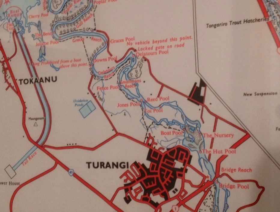
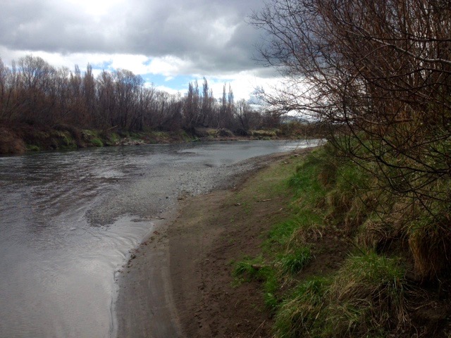
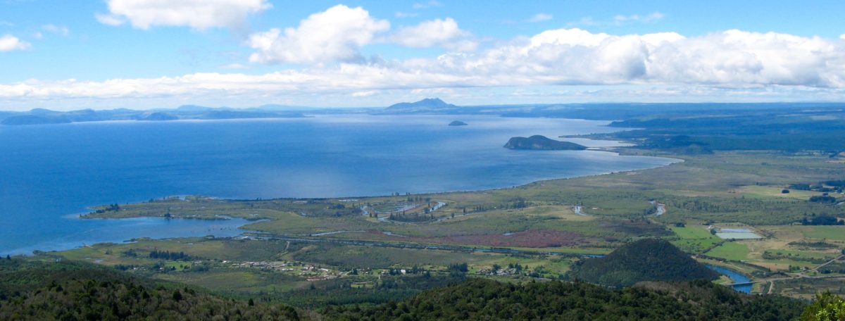
 Above 1978 ( NZMS 116) Lands & Survey Map with Lower Tongariro River pools as they were… today the TRM Daily Report is all about “Smallmans Reach”.
 (Photo on right is Max Jefferies from Pukawa who landed his fine rainbow trout from what is left of the tail of Smallmans Reach on Monday morning. That is added to earn your undivided attention.)
This Daily Report started out all about the delightful story of a 4WD that drove to the very edge of the lower Tongariro from the end of Grace Road – for fishy ‘humanitarian’ reasons.
But I need to have a rant first – to vent our visiting tourist anglers’ frustrations. We constantly get it in the ear from so many overseas anglers who have traveled so far and are brave enough to explore down river and then return speechless and astonished. They cannot believe the level of destruction in the old classic lower river pools that they have returned to fish for many years, whilst we are at a loss on how to explain it. So we promised to pass on their concerns…
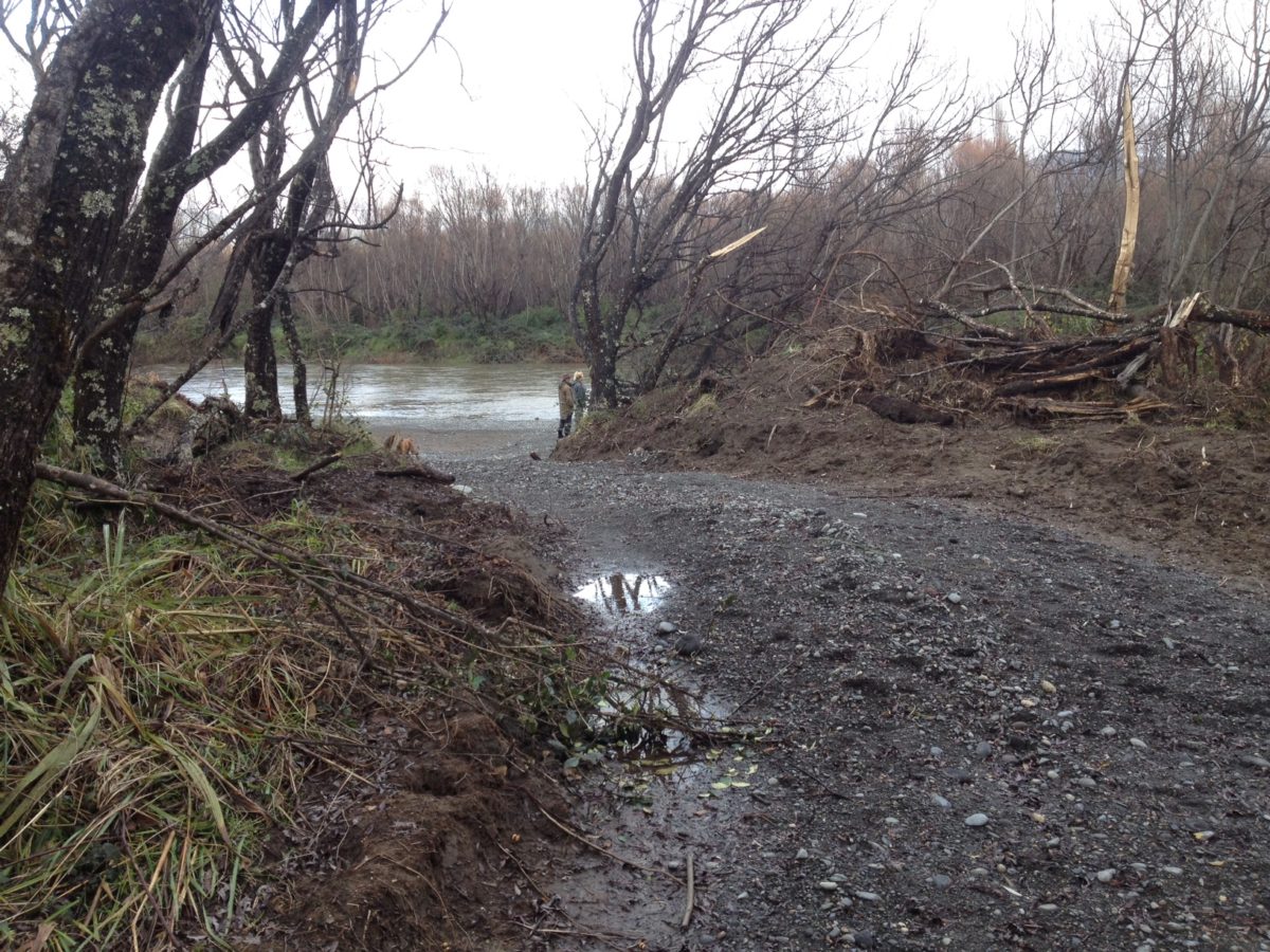
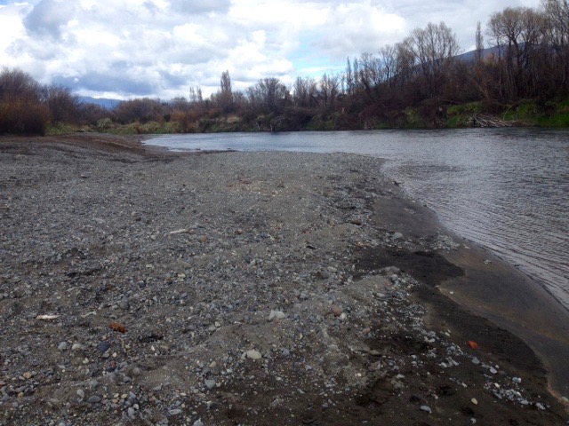
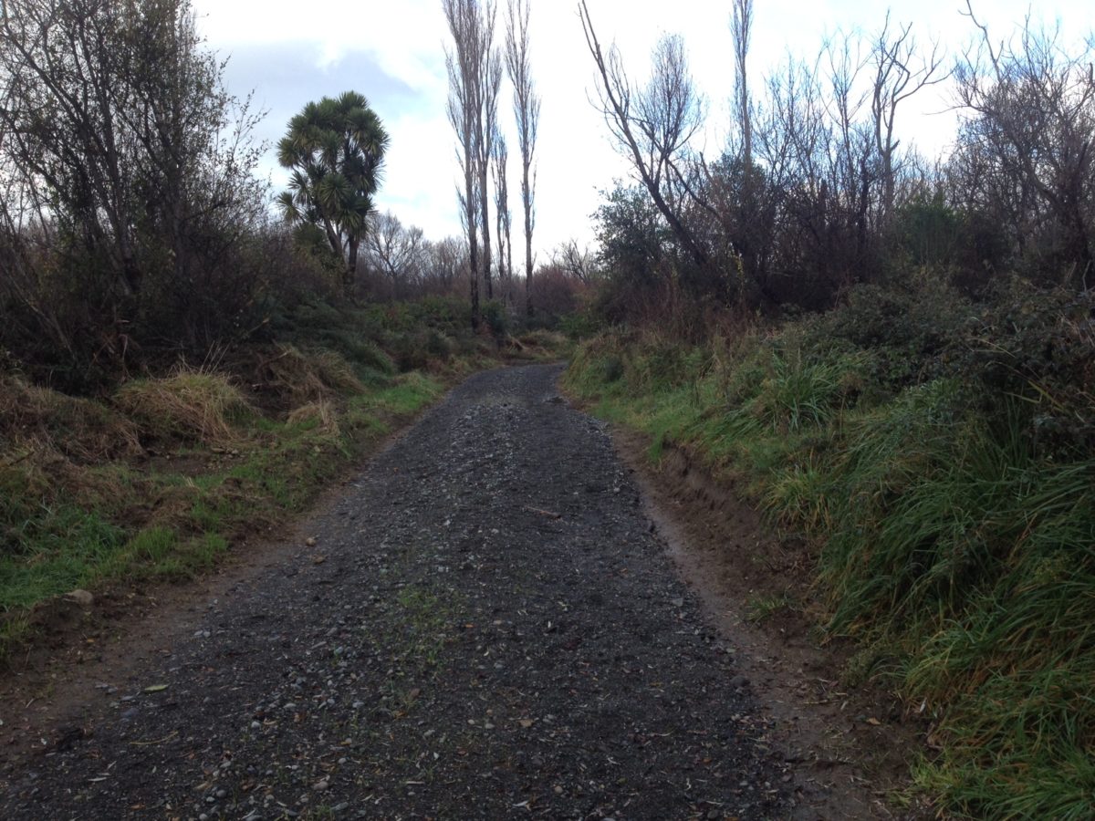
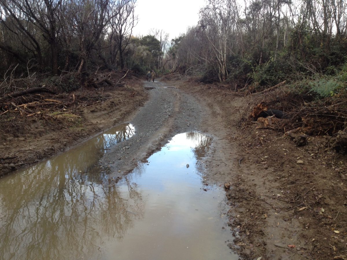
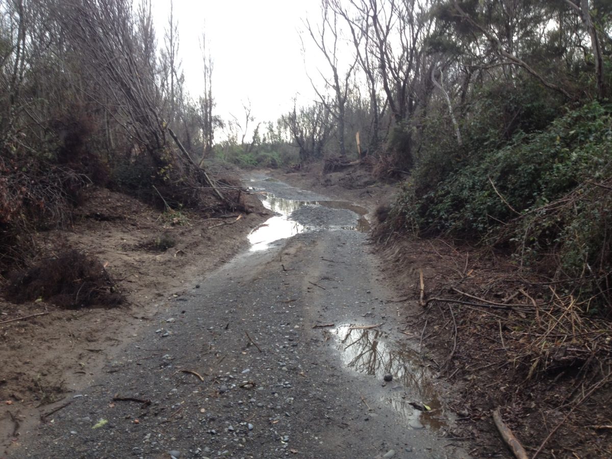
The photos show the track that was pushed through from the end of Grace Road to enable access for large trucks and a digger – to cart away all the gravel from the river edge – what anglers used to call “Smallmans Reach”.
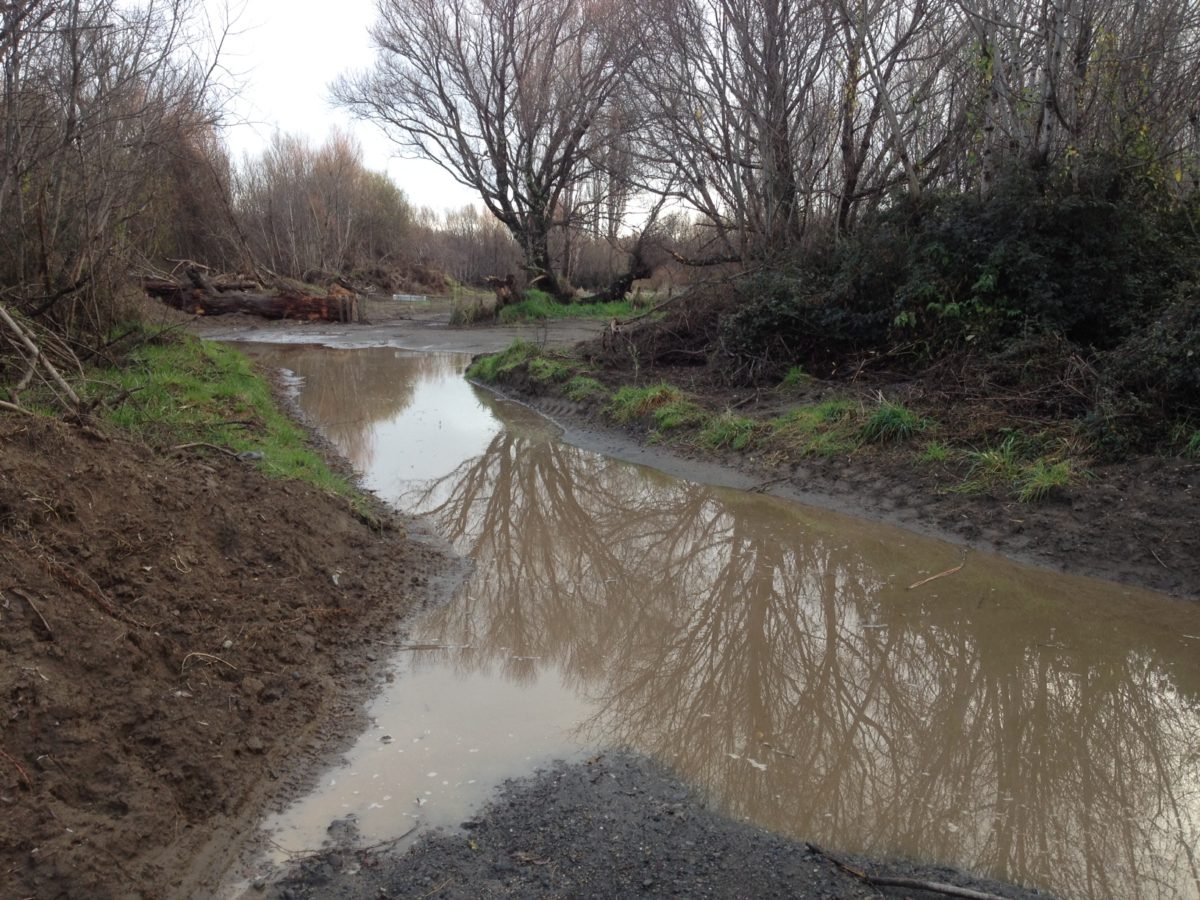
 They have now excavated everything they can and basically ‘stuffed’ any potential for wading and casting from the long beach – previously known for many years as ‘Smallmans Reach’, (see 1978 map above) on the TRB (True Right Bank) above the old Bends Pool which also disappeared after Council’s flood protection (?) earthworks, when the river burst through about four years ago – see photos below.
A plea – can someone from Council please write to explain how removal of gravel down river can assist to prevent flooding Turangi? That is what they claim… How is that in the public interest? It defies logic. It defies gravity. It is an insult to the intelligence of anglers.
 TRM have been told it is simply all about the money?. What a surprise! Apparently there is a shortage of road metal in this region – where much of the substrata is pumice – so Waikato Regional Council want us to believe that removal of the Tongariro gravels is in the greater public interests. Is someone paid ‘royalties’? We understand the abandoned metal quarry on the TT (Tauranga Taupo River) is now exhausted so the Tongariro River banks are now targeted. Earlier they pushed another new road through to Downs Pool (where the boat limit sign used to be below De Latours Pool) to extract gravel but must have exhausted the supply from there so the contractors have moved their quarrying operation further up river towards Reeds Pool – still out-of-sight to public scrutiny.
 Too bad about the damage done to a world famous trout river being quarried during winter spawning runs.
Too bad about the destruction of the largest brown trout spawning area and trout nursery for Lake Taupo.
Too bad about the damage to NZ’s largest industry – tourism.
i.e. Turangi only has one industry – called ‘tourism’. This mainly revolves around fishing the Tongariro. In DOC’s own 10 year Taupo Fishery Review (Department of Conservation manage the Taupo fishery) they analysed that 66% of all tourists visiting Taupo came here for the fishing.
 Yet the Regional Council works programme continues to discourage these valuable tourists by allowing this environmental vandalism and river carnage to continue. Even more surprising and questionable, DOC have approved the metal extraction works programme too (see their letters of explanation below when TRM previously reported on this in early June). No wonder overseas tourists are choosing to fish elsewhere? (SWMBO wishes John Key would take up fly fishing instead of golf or speeches to United Nations Assembly. Acting as ‘Minister of Tourism’, he could stop this wanton destruction of a world class tourist trout fishing facility by lunchtime.)
This is so sad for many older anglers who are restricted to the lower river for easier access and wading. By the time the river boulders have ground their way down the river in seasonal floods the boulders are reduced to mere pebbles by the time they get down beyond the Braids.
 Many older anglers (with replacement knees and hips and ankles) suffer from stumbling over the big boulders up river, so concentrate their efforts in the lower reaches only. Now the Council works plan appear to be destroying any wading access to the pools ahead of them.
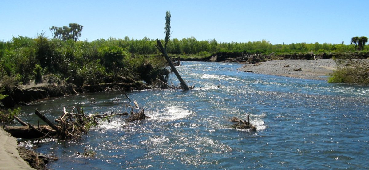
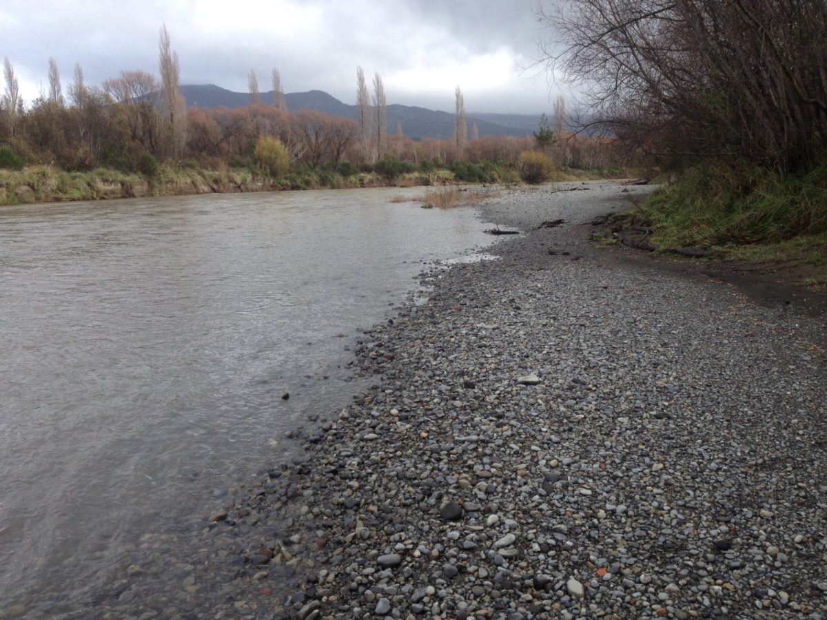
The location is just above the mess where the river burst through and bypassed the old De Latours Pool in October 2012, despite desperate attempts by Council contractors to erect puny retaining walls to cover their mistakes in an attempt to prevent that break-through from happening.
Many tourist anglers have lamented on the loss of the De Latours loop which previously provided some of the best brown trout summer dry fly fishing on the river.
 It is now a stagnant smelly backwater cut off completely by the break through in the photo four years ago. It has still not recovered and the awful ‘snaggy’ mess left behind four years later – see photos – is unacceptable.
It can only be described as environmental vandalism.
You can imagine the horror from overseas tourist anglers who return there and cannot believe we allowed the Council to ruin some of the best summer fly fishing in the world.
They don’t return… Who can blame them…
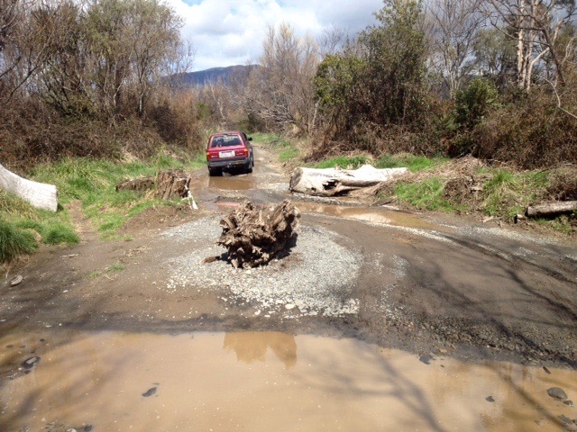
 Hopefully the images are self explanatory to illustrate the 4WD access track and to show what is left of the “Parade”.
The access is really only suitable for 4 wheel drives vehicles (or rental cars?) or horses. The beach – aka Smallmans Reach – might eventually recover its shape to enable anglers access after a few more floods sort it out, but at present the soft sand left behind looks too marginal and may be too dangerous for wading.
 The photos above show the tree trunks that were left to block off the access from Grace Road. These have now been moved or chain-sawed up for firewood. The humps in the track have been smoothed out but still may be too severe for the family car. Rental cars should manage to bump over them.
Now back to the original fishy ‘humanitarian’ story, just in case you imagine I had forgotten…
Sometimes we have to confess we can get carried away – reporting realistically and honestly about these issues can be depressing…
 So we understand you might need some balance in the form of good news as well.
Faced with such carnage down river, we need continual reminders of how lucky we really are to enjoy such good access to a world class trout fishing river – despite the Kremlin’s best efforts to destroy it.
(Photo on right of another inmate – Steve Ogg from Masterton – with his keeper landed in the upper river yesterday. Another inmate, Adam Barton, landed five and lost six down river yesterday. But keep it to yourself – what is left is really is a little slice of Paradise.)
The way we heard it – we were not there or we would provide photos – was that this 4WD backed up to the lowest end of the run when the driver and his mate got out and carried a plastic chair from the vehicle and plonked it right on the river edge. Then they assisted an older bloke who suffered limited mobility problems to the chair. From that seated position he could still just manage to cast a woolly bugger into the tail of the run and tickle it to annoy any trout in the deep hole. They left him there while they explored further up river.
 Half an hour later they returned empty handed to discover the old bloke stranded in the plastic chair had two on the bank…
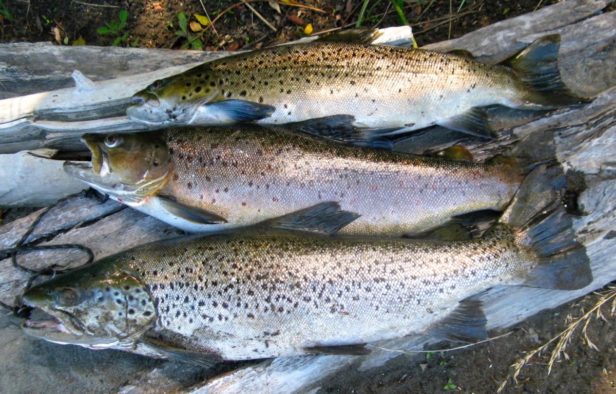
(“Historic” photo on right is one of my limit bags of brown trout caught on dry fly in January 2014 from the old De Latours Pool – now transformed by Council’s master flood protection plan into a fetid putrid smelly puddle. After flying in from overseas for the much heralded Tongariro spawning runs – is it any wonder the tourists get upset?.)
TRM Daily Report 3 June:
New angler access to Tongariro River…
A new access road has been ‘bulldozed’ through the scrub at the end of Grace Road.
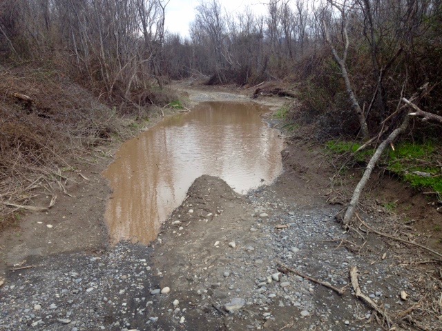
 (The photos were taken on Sunday 29 May after a 200+ cumec flood.)
The location is just before the car parking area where the gate is usually locked (see photo above) to discourage people from visiting the gravel pit where Downs Pool used to be.
This was the most important brown trout spawning area on the Tongariro River but now WRC – Waikato Regional Council – prefer to extract gravel…
They will no doubt call it essential ‘flood protection’ excavations?
Now another metalled (4wd) road has been formed to connect with the only pool below the Reid/Jones Pool beach – towards where the Bends Pool used to be (but was destroyed by Council ‘improvements’….
Anglers were delighted that the Council have finally provided them with an access track?
 But beware, the entrance is blocked. Park in Grace Road. However it has made walking access easier.
![]() One would hope they might advise anglers what is going on? When they say nothing then the local TRM conspiracy theorists claim they do not want anglers to know the real reason. Perhaps they have exhausted the supply of metal from Downs Pool corner beyond Grace Road and are now moving up river towards Reid Pool…?
One would hope they might advise anglers what is going on? When they say nothing then the local TRM conspiracy theorists claim they do not want anglers to know the real reason. Perhaps they have exhausted the supply of metal from Downs Pool corner beyond Grace Road and are now moving up river towards Reid Pool…?
Grace Road has also been widened (?) by slashing the sides to keep the blackberry back – possibly to allow larger trucks access to the metal quarry.
TRM emailed Todd Baldwin at Waikato Regional Council who advised:
Hi Ross,
Thanks for the email and pictures.
 The track there was opened up recently by private contractor to gain access to the built up gravel shoal on inside of bend there.
Gravel was taken for tracks on surrounding land blocks.
They have finished the work and there is no more gravel extraction planned.
No intention of track being used for 4wd access and should have been blocked off, however foot access should remain.
Regards,
Todd.
TRM also enquired from DOC – as follows:
Hi Ross,
 The road was put in place by a contractor removing gravel from Smallman’s reach area of the lower Tongariro River, with the permission of Waikato Regional Council.
Accretion of river gravel on the inside of this bend in the river has been previously identified as likely to cause accelerated stream bank erosion. This site was identified for potential gravel removal in the WRC 2015/16 Annual works programme.
The purpose of excavating the accumulation of gravel on the inside of this bend is to allow elevated flows to occupy the flood plain of the river channel lessening the previously concentrated water flow on the outside river bank during flood flows that has been causing the bank erosion.
The excavation of this gravel was undertaken by a private operator utilising permitted activity rule 4.3.10.1, with the knowledge of WRC, with permission of the gravel owners being the local Iwi, with the gravel being used on adjacent Whanau land to maintain access on their land.
There is no intent for the road to be used for vehicle access for anglers, although obviously they will be able to use it for foot access.
I can’t elaborate on the further use of the road, as I am unaware if WRC has any intent to remove more gravel at this stage.
Hopefully that helps clear it up?
Cheers
Dave
Dave Conley
Operations Manager Taupo Fishery
Turangi Office | Central North Island Region
G Level 1, 69 Town Centre, Turangi 3330
E 027 2370089 or (07) 384 7116
Department of Conservation, Te Papa Atawhai www.doc.govt.nz