
Mt. Tihia
When TRM posted some aerial panoramic views of Turangi photos taken from nearby Mt. Pihanga and Mt. Tihia, it immediately resulted in more enquiries on how to get there?
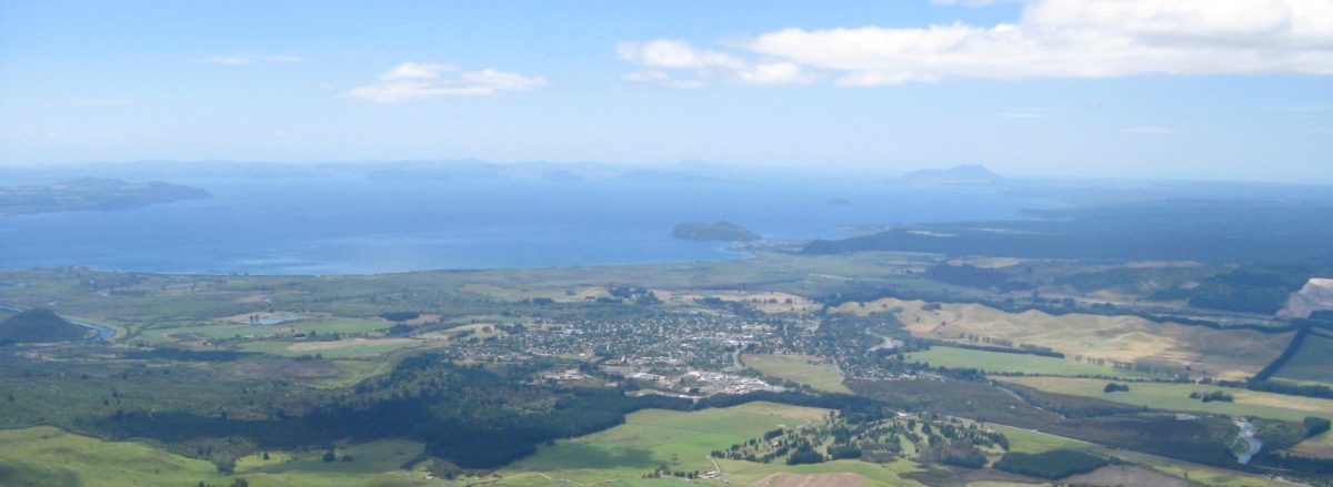
 Forget Mt. Pihanga – you really need a helicopter. We have tried to climb it from the southern side but failed. Too difficult.
The photos of Turangi and surrounding National Park images were taken for us by contractors doing some work to the installation on the summit – see photo on right:
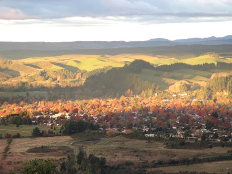 This autumn colours view above, from Mt. Tihia was taken in July 2006 – a very late Autumn. By 2026 many of the Autumn colours have gone. All part of Toe Paw’s beautification programme.
 A good alternative option, largely unknown and unsignposted, is Mt. Tihia.
For Mt. Tihia track, the access is off the ‘Saddle Road’ (SH47) leading up from SH41 over to Lake Rotoaira.
A few years ago TRM produced a very brief slide show to illustrate the views available – it was not one of our best efforts… This was deliberate as we did not want to promote the location too well as this is a hard-to-find unmarked track is in a Kiwi Zone (NO DOGS!) in the National Park where it is more sensitive to tourist pressures. It is also a know habitat for Hobbits who do not like to be disturbed.
This climb is particularly suitable on cold windy days like we have experienced recently. The tracks are sheltered below the canopy of thick secondary bush and are only exposed at the ridge when trampers emerge above the snow line.
TRM have lost tourists on the Mt. Tihia several times now, so make sure you take a map or hand-held gizmo to follow.
Below is another short slide show by Kiki and JimTim when they led some young friends to climb Mt. Tihia and they wandered off the track so pretended they were looking for Hobbits.
They emerged again on SH47 at the car park for Lake Rotopounamu about 3-4 km south from where they entered the bush track.
Tihia Track
Track Description from NZ Tramper: A rough loop track and hard to find. But a worthwhile trip to a summit with wide views around the central plateau.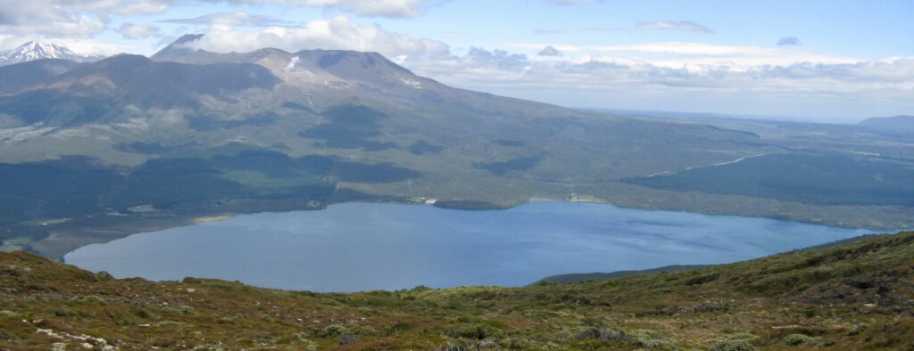
The track climbs gently through bush onto a spur to the north of Tihia. There are some informal markers, but generally you are following the pad on the ground. As the track nears the bush line it becomes rutted and scrubby but soon pops out onto the spur where there are a couple of rocky places to rest and enjoy the view to the north.
The track now continues to the top of Tihia through tussock and scrub. It is overgrown in places but well defined when you can see it.
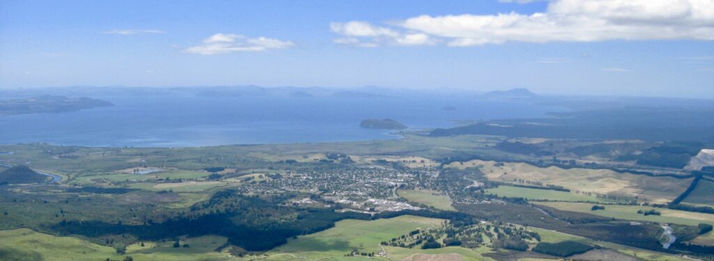
At the top of Tihia the view of Tongariro, Lake Rotoaira, Pihanga and Lake Rotopounamu is added to the view you have already had of Lake Taupo, Turangi and Tokaanu.
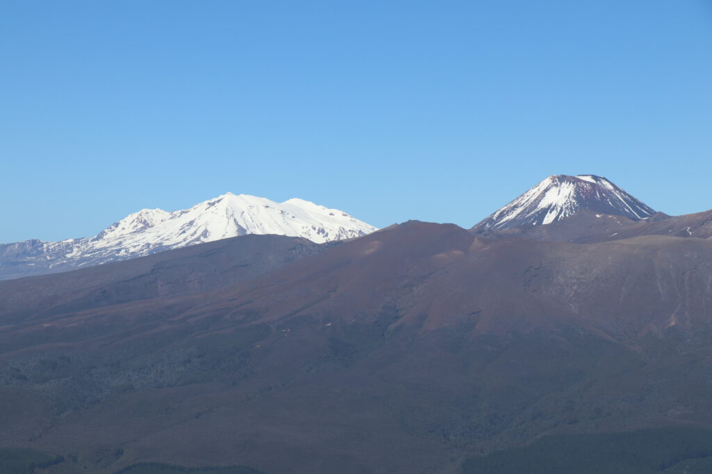
The track continues past the summit to the south and is hard to find until you get to a descent through a rocky patch, marked by stone cairns.
Once again the track is eroded and overgrown as it passes through scrub. However the going becomes more pleasant in the bush. It then descends along a broad ridge to the highway. At one point, it pops out onto an old benched road marked on the map. This is a relic of the construction of the tunnel between Lake Rotoaira and the Tokaanu power station, which lies directly below our feet. Follow the road for about 50m, then turn downhill where a broken white highway marker lies beside the track.
It is a short distance from here to Highway 47, just to the south of the road summit. Memorise where you came out of the bush as this is the only way you will be able to find the track if you ever want to go in this way again.