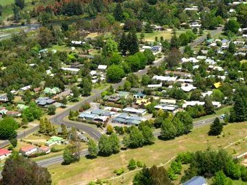
 Last week TRM (Tongariro River Motel) received a circular from the Taupo Council advising to meet with them next Saturday to discuss the flood liability for properties in Turangi. No problem – or so we thought – as TRM was built here in 1951 and was not threatened by the big Tongariro River floods in 2004 and 1956. But SWMBO insisted we should check so we wrote and asked for the flood hazard “Process Map”.
Can you believe there was a nasty red dot warning on TRM’s lawn. Yikes!
 This is more serious than you might imagine. Anglers would probably survive as they usually wear their waders to breakfast but a few tourists might not enjoy wading through their units when the next 100 year flood occurs. That would be far more serious.
It gets worse. They advise Waikato Regional Council are now intending to increase our rates to fund their flood protection works on the Tongariro River. Then they get Taupo Council to explain their flood hazard plan. Isn’t that deceitful?
You can imagine how excited SWMBO is about that. (She Who Must Be Obeyed manages everything at TRM, particularly flood management and political protests) In response to TRM’s inquiry Council sent the following:
If you click on this link it will take you directly to the correct place on the Council website to view the mapping tool to see the effect on your property. http://boplass.maps.arcgis.com/apps/webappviewer/index.html?id=e38f5ced0da54c06bd821f2e76ba6e95
There is more information on this flood hazard plan change on the Council website. Click this link to see the relevant page of the website. http://www.taupodc.govt.nz/our-council/consultation/Pages/Flood-hazards.aspx
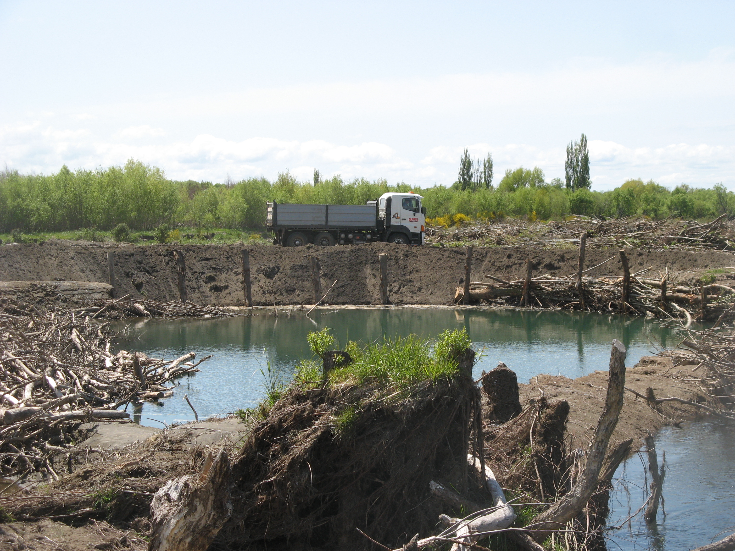
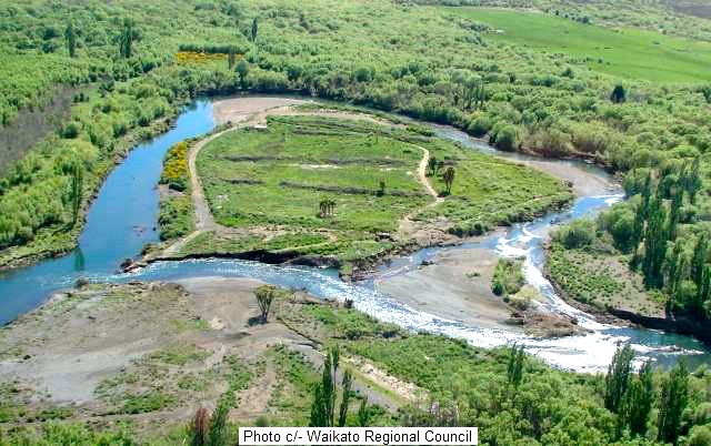
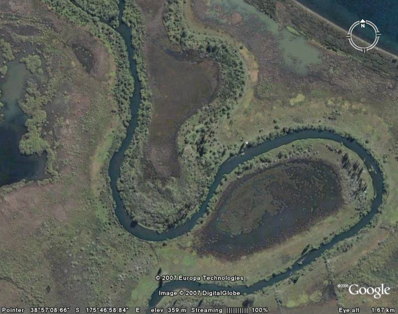
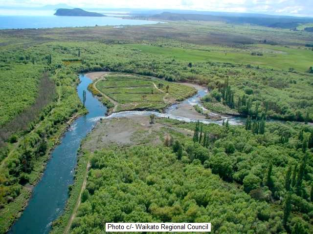
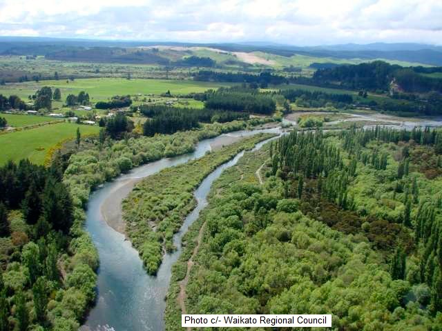
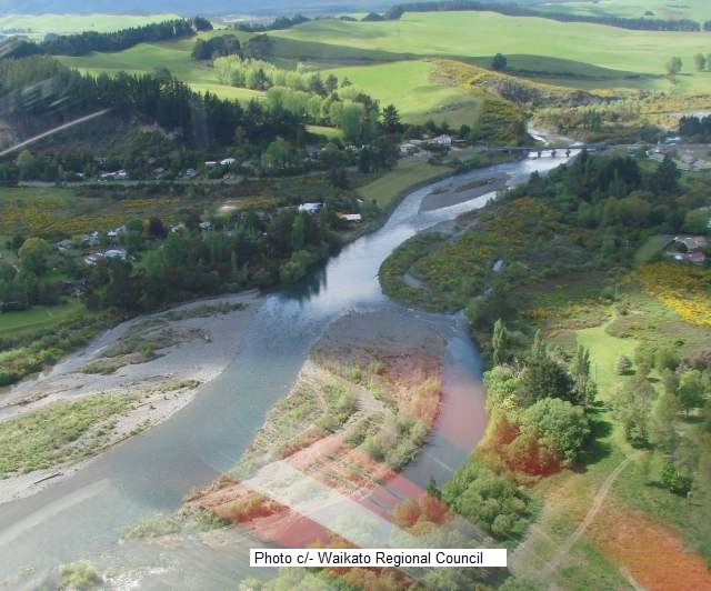
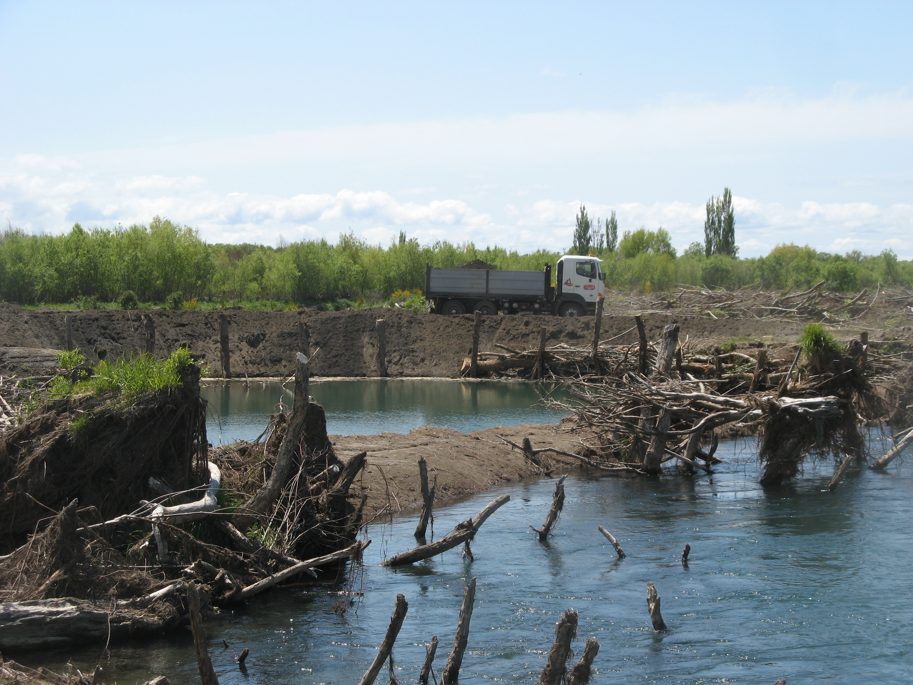
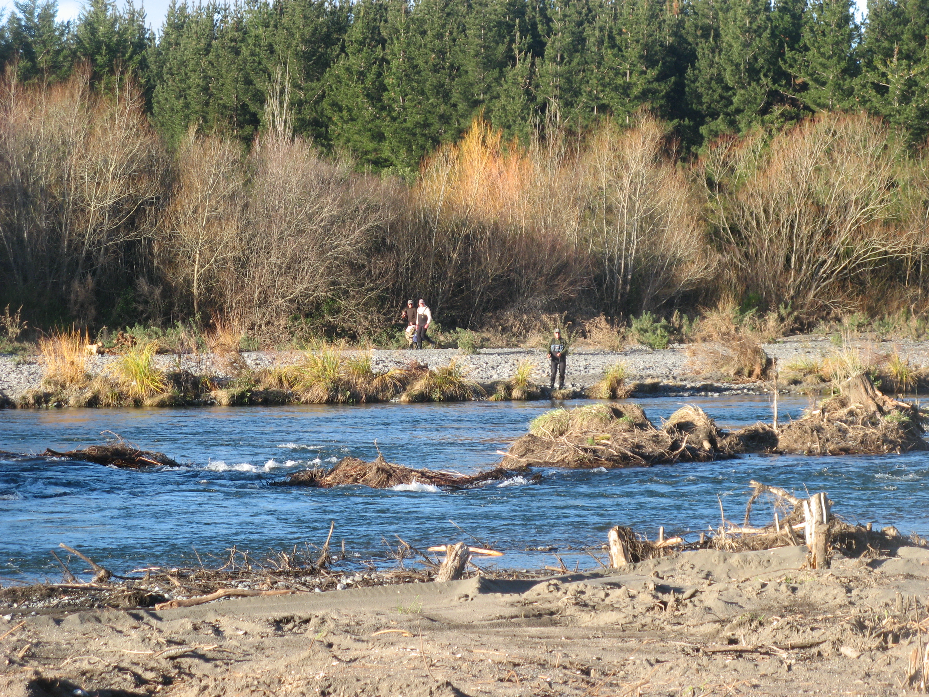 Regular readers of TRM Daily Reports will be aware that the Council ‘flood protection’ (?) excavations down river were responsible for ruining the Braids – the most productive trout fishing area below the bridge – by digging a new canal to bypass the Braids which then blew out the lower river beyond the Bends – see Waikato Regional Council (“WRC”) photos. WRC are still quarrying metal down river, out of sight beyond Grace Road, ruining important brown trout spawning redds and destroying the biggest brown trout nursery in NZ. Environmental vandals?.
At this point we should comment on the importance of maintaining the Tongariro Fishing natural environment to encourage tourism – our biggest local industry….
 TRM would have to pass on increased rates by increased room rates to help fund the WRC to ruin your favourite fishing river. We know that would be commercial suicide.
WRC refuse to acknowledge the river is not to blame for flooding. Turangi managed without floods for several thousand years until the WRC started meddling by raising the lake level of their hydro dam – water is gold mentality – at the expense of the environment, tourism, trout breeding, angling and TRM. Now they want ratepayers to pay for their flood protection works. Extraordinary cheek. SWMBO does not accept that. That is why She is manager.
 The real problem is the increased lake levels. The natural level of Lake Taupo disappeared in the 1940’s when the lake was raised by the installation of control gates at Taupo. The lake was changed to a hydro storage dam. Since then the level has been raised several more times to increase the reserve to fuel all those hydro turbines on several power stations down the Waikato River.
This was compounded by the Tongariro Power Development. (If any inmates are interested in all the background TRM have the dvd of the TPD “UNDERGROUND – Tunnelling for Power” by John Ball.)
 The TPD scheme collected natural run-off from Ruapehu and Tongariro National Park and redirected it through more power stations into Lake Taupo. This increased the flooding issues even more.
Now when there is a serious flood – such as last June when the flow reached over 700 cumecs, the increased river flow (usually around 25 cumecs) has nowhere to go. It hits this hydro dam called Lake Taupo and backs up to Turangi. Now whose fault is that? Ratepayers? What bollocks! WRC are responsible.
 Here is just one example: The TPD approval was conditional upon a dredge positioned at the delta to make sure the Tongariro River outlet was dredged. On completion of the power scheme it was used to excavate the canal at Lake Otamangakau and then was moved to Twizel. It has never even been seen on the delta.
So the power company controlling the lake levels has to be held accountable. You don’t have to be an Einstein to work that out. It is simple common sense. But Council cannot get their heads around it relying on their “consultants” to confuse them. Then they imagine they can pass the costs on to unfortunate gullible rate payers living near any of the Lake Taupo tributaries. That is bizarre. Quite ridiculous.
 So how did TRM win the lottery to get a high hazard red dot on our lawn? Each area has been classified into low, medium and high risk zones. The satellite that decided the classifications spied the old swimming pool at TRM. It was filled in about eight years ago which illustrates how obsolete their data is. Council were immediately notified so intending guests and fishy inmates should survive from the rain today. Just to be sure, the ever cautious SWMBO recommends anglers to wear their waders to bed.
The solution to this problem is so obvious that SWMBO cannot believe Taupo Council have missed it.
 Instead of billing ratepayers for the excessive lake levels causing potential flooding, they – Waikato Regional Council – should send the entire bill of costs to Mighty River Power who are responsible for maintaining the excessive lake levels at the Taupo control gates and therefore caused the problem.
All the Tongariro River needs to flush out all the ‘aggradation’ is to lower the lake for a couple of months each year when power demands are at their lowest. (‘aggradation’ is the geographic term for the process of a river depositing sediment on its bed, therefore raising its bed and causing flooding)
So simple really and much easier than a ratepayer revolt.
Below is TRM ‘s video of the lower river mess caused by Waikato Regional Council.