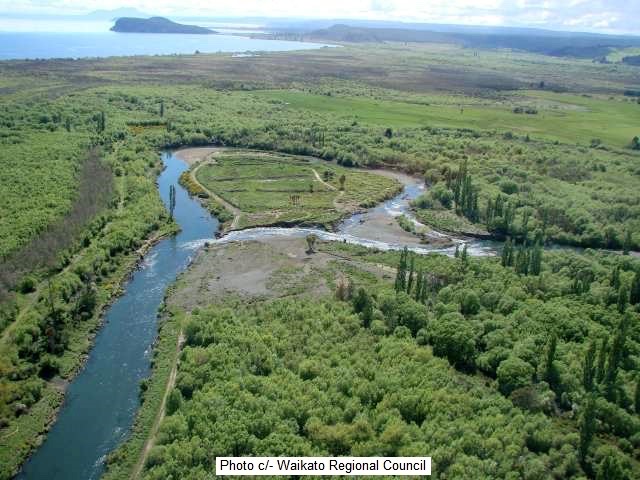
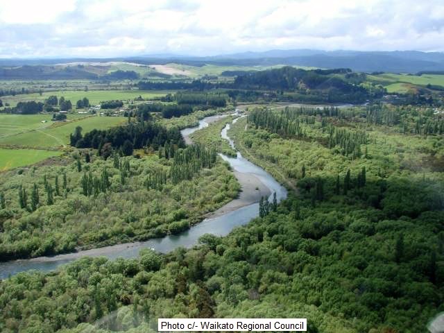
A recent TRM blog casually included an aerial photo of “de Latours Pool”, which prompted many viewers to ask leading questions about what happened. i.e. Is that man-made diversion? This reference to de Latours obviously touched a nerve with many older Tongariro anglers who fondly remember and are missing the glory days downriver. As this was once considered the most important brown trout nursery for Lake Taupo, many fishy readers were upset. Everyone has their own version and opinion of the Council’s merits or habitat damage, so this TRM report provides more historical photographic evidence to assist in any decision on river management.
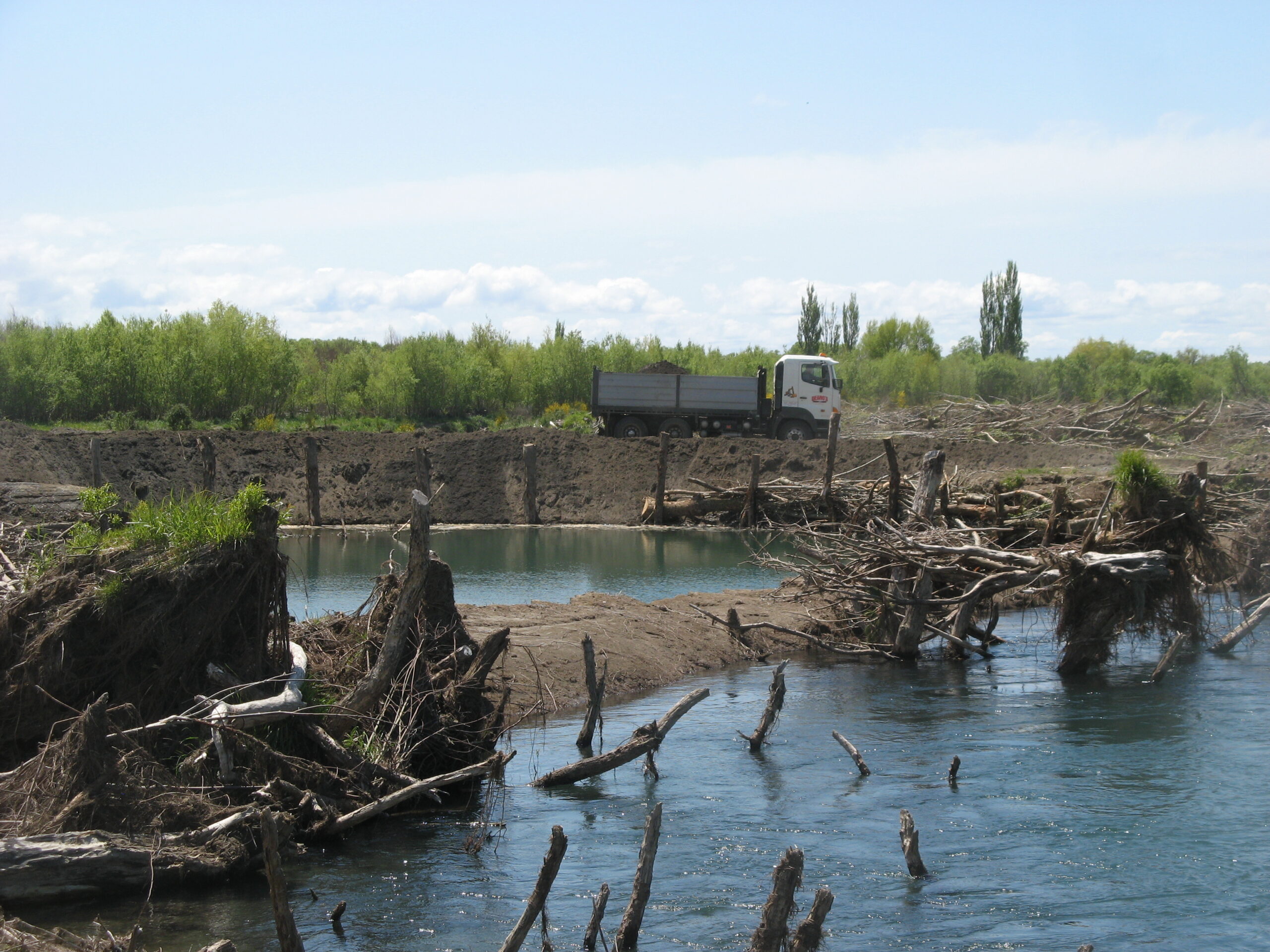
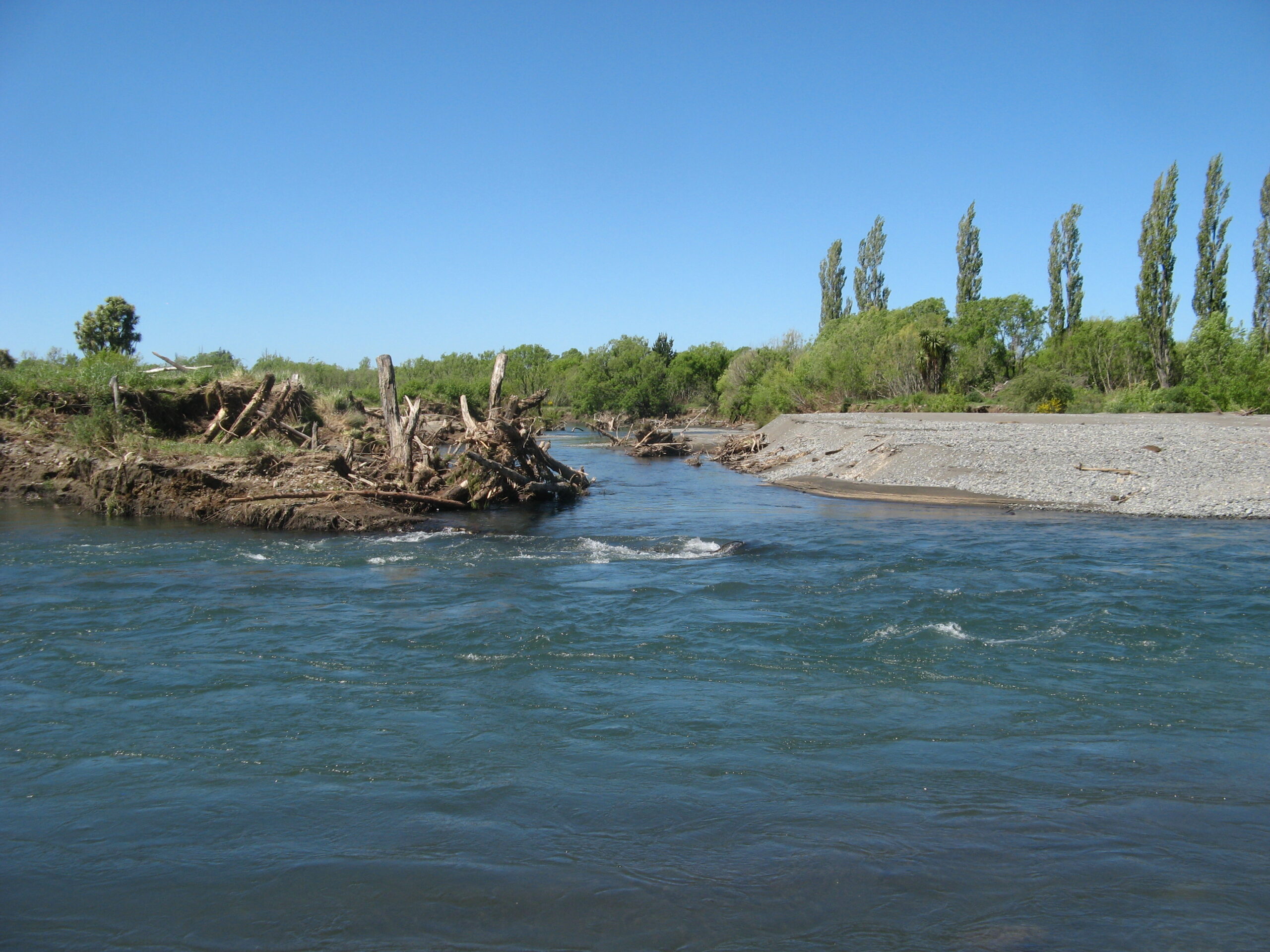
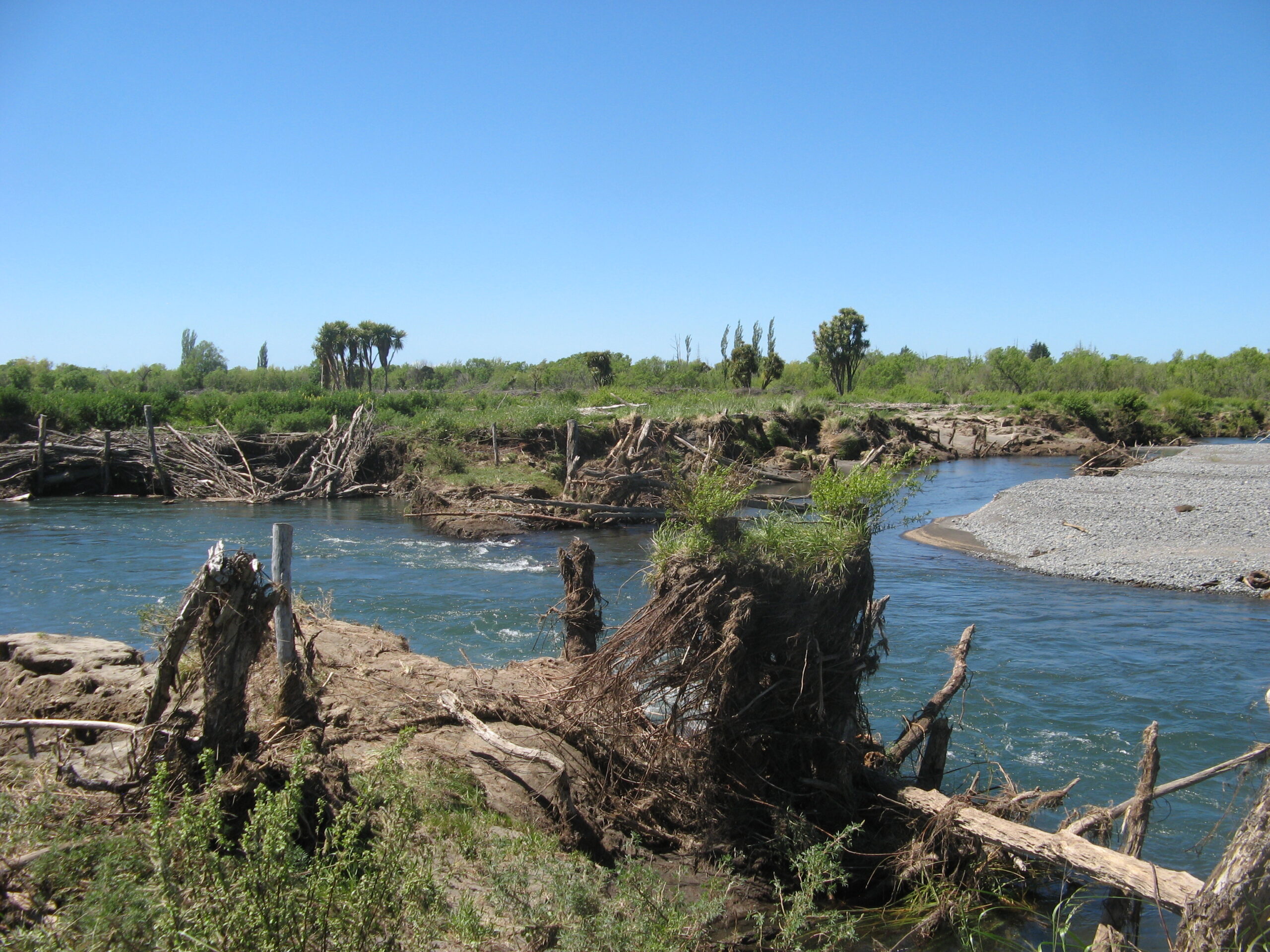
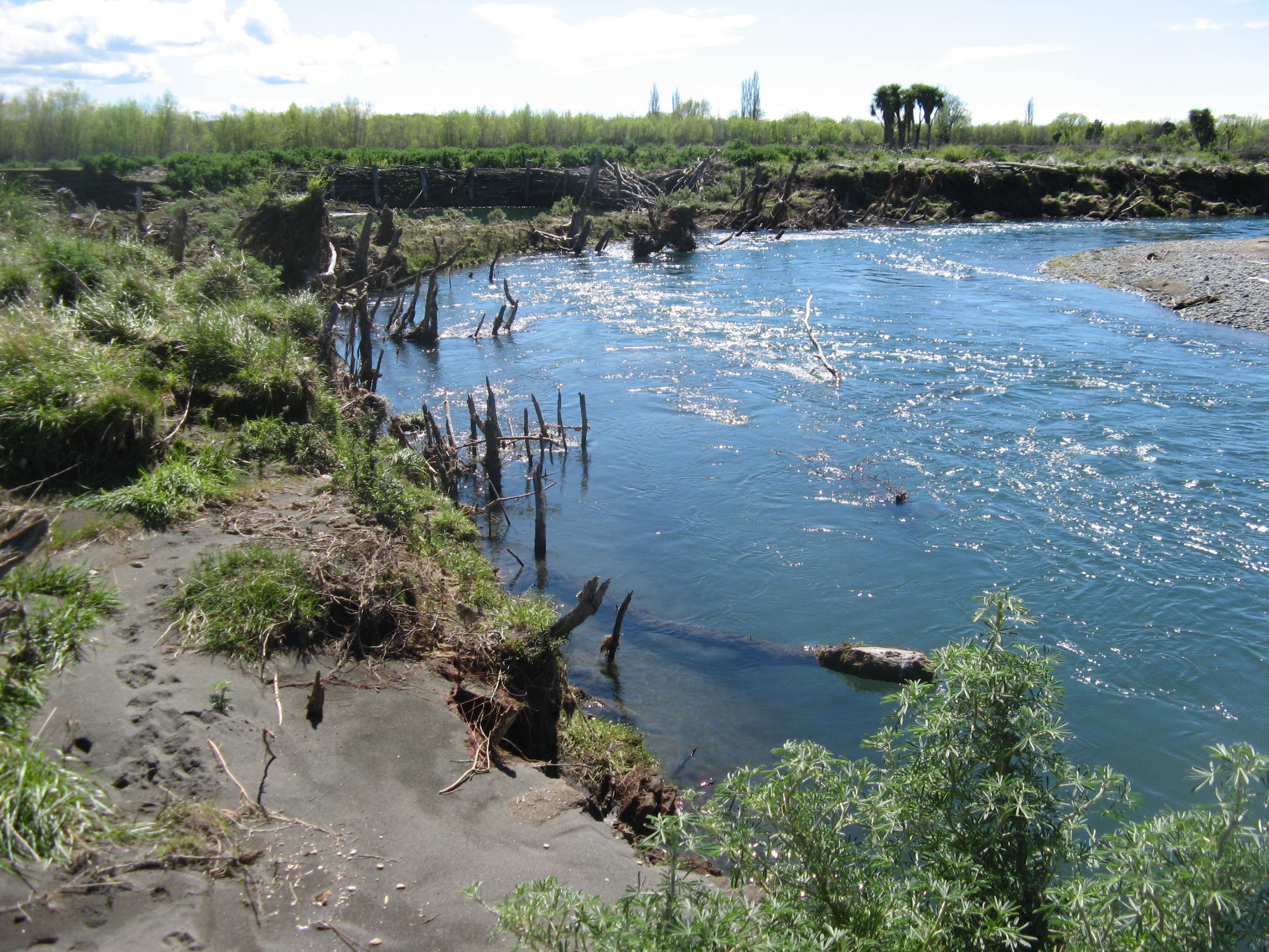
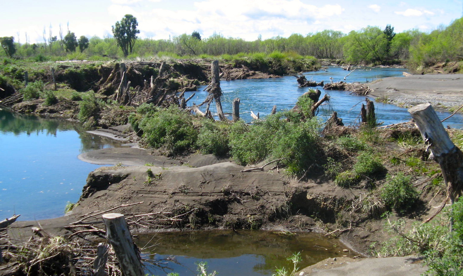
TRM anglers’ photos below illustrate some of the mess created in the Bends Pool area in 2012 & 2013. The lower river has never recovered. The Council’s efforts to control the flow and prevent further erosion on the True Right Bank resulted in a breakthrough below Smallmans Reach, connecting directly to de Latours Reach.
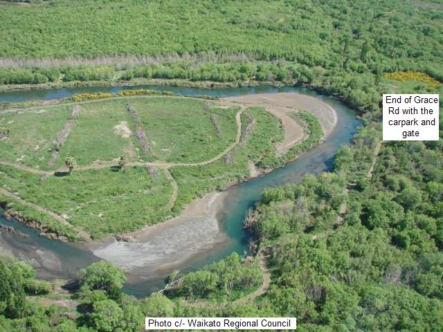
Photos below illustrate the damage when they tried to build a timber retaining wall to prevent the breakthrough at the Bends. All the logs and trees were eventually swept downriver to provide challenging snags for future anglers. Now, 12 years later, readers can decide for themselves on any long-term merits of the Council’s work. Was it necessary for flood protection or as excavations for a metal quarry? Most of the feedback reaction from anglers was negative and not suitable for repeating.
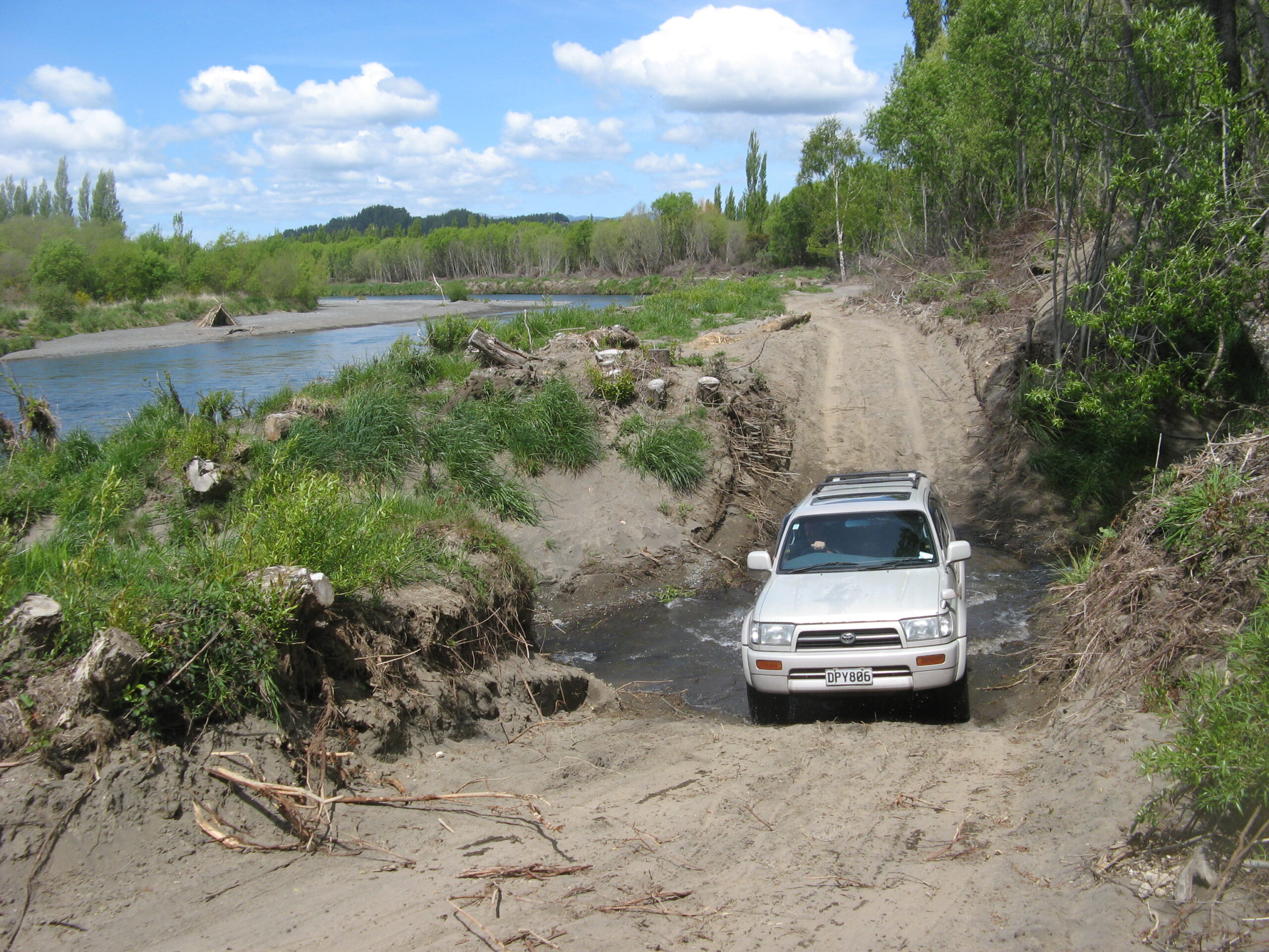
These access tracks down the TLB have now eroded or grown over.
It is still difficult for tourist anglers to understand how this deterioration was allowed to occur on such a world-famous tourist trout-fishing river. We sympathise with many disappointed regular tourist anglers who had visited over many years but have not returned. They suggested this eco-vandalism would not be tolerated anywhere else.
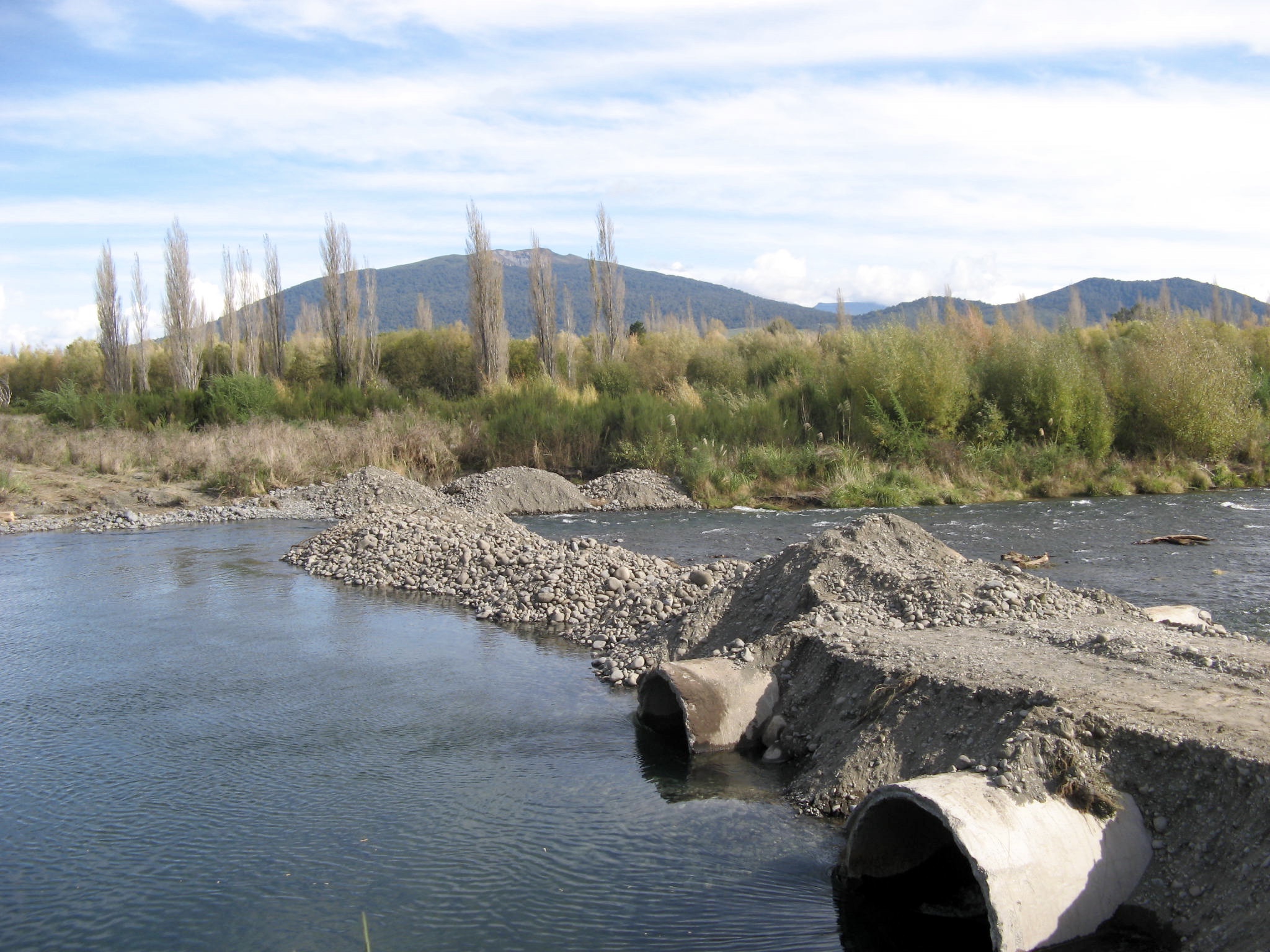
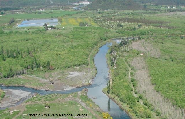
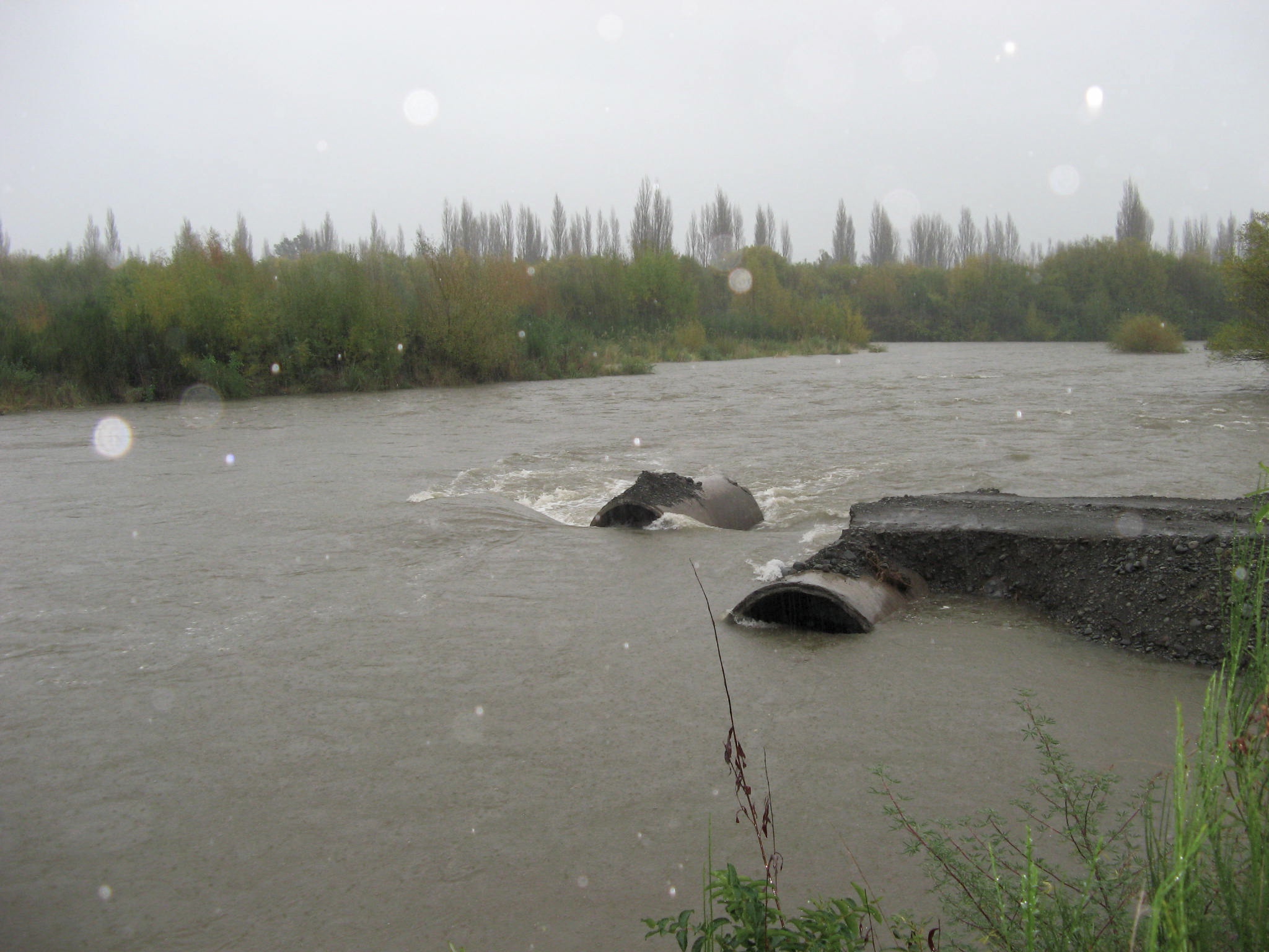
The de Latours shambles was not unique. As another example, the photos above were taken in June 2006, a few days apart, when the same authorities tried to form a construction road across the Braids to remove metal. The pipes remain abandoned in the river.
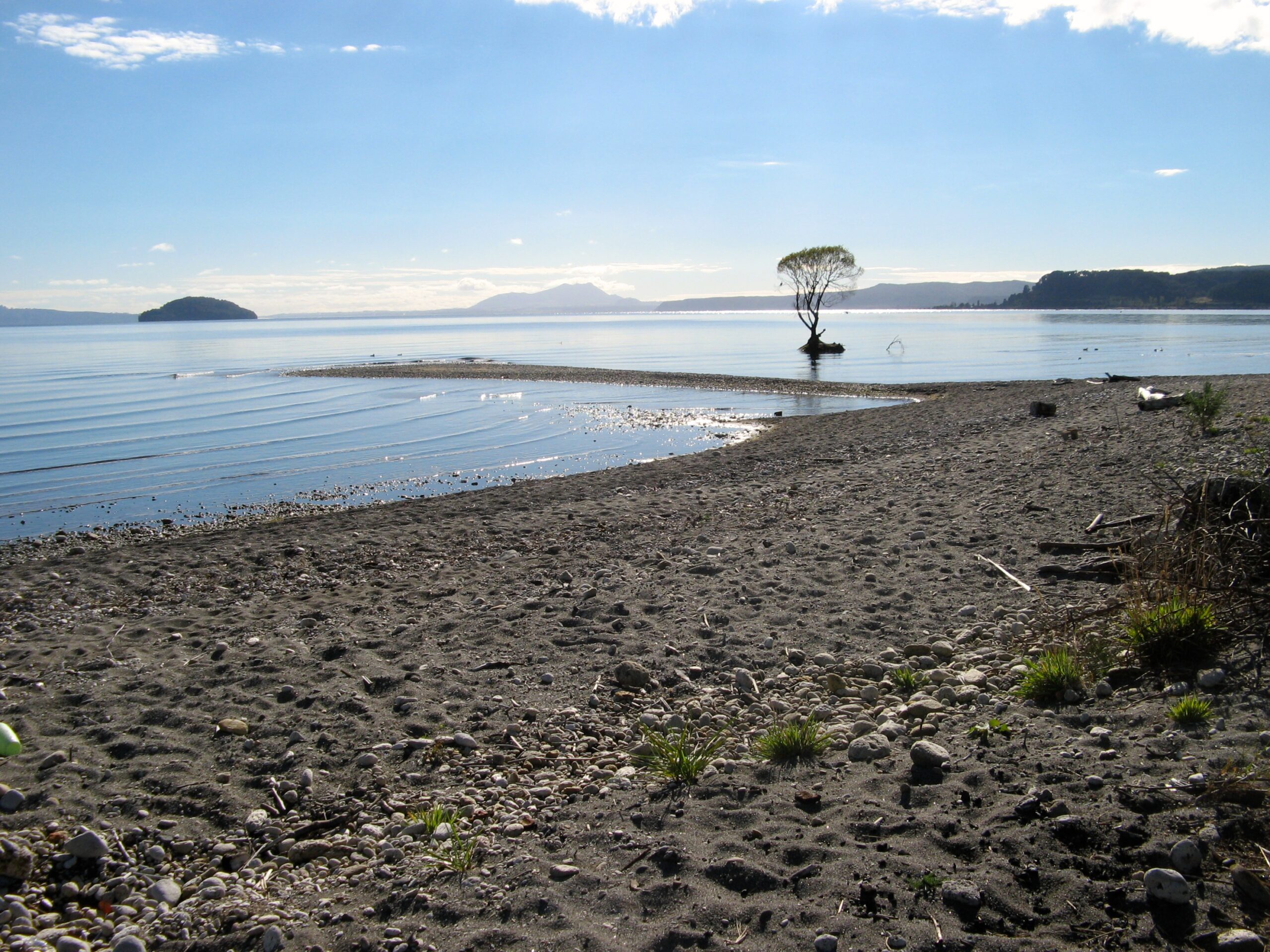
A clear visual indicator of how much Lake Taupo has altered is this willow north of the Tauranga Taupo River mouth. It once grew on the foreshore. Now it is in the lake. The lake was raised in the 1940’s after the installation of the control bridge at Taupo. The significance of this, in addition to increased erosion around the entire lake, was that the Tongariro River flow suffered when the river water levels were very close to the lake levels. Then the river backed up, increasing aggradation, which covered the stony base of the lower river beds.
For interested readers, tomorrow TRM will continue this gripping historical account of the sad deterioration of the mighty Tongariro River, to try to explain how this happened and how the government lied and deliberately misled about the likely consequences of the hydro power project.