
Some more nostalgia, specially for Brian M in West Island – thank you for your correspondence and memories. Some of the local historic photos that popped up on facebook recently mixed up with old TRM snaps.. In case some are private or copyright (?) we apologise in advance.
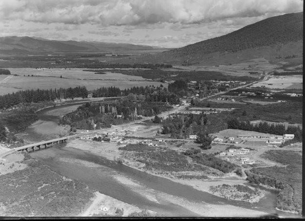 Early aerial of Taupahi Road south of the road bridge over the Tongariro River. In foreground is the school. Not even a sniff of Turangi town. TRM is hiding in there somewhere peeping through the trees.
SH1 was formed to the west of existing Taupahi Road to bypass TRM which ended up on the corner site instead.
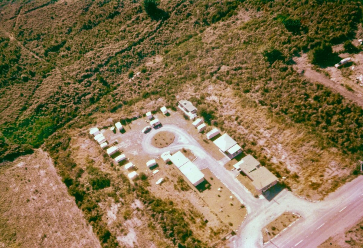 Tongariro River Motel in all its glory about 1960 – the only motel in town. Well there was no town really but more a smattering of holiday homes and fishing shacks.
The front building (now Units 1 & 2) was the village shop with owners flat (Unit 3) at rear. The other motel units (now Units 4, 5, & 6) have all since been extended.
 Most of the land was used as a caravan park. SH1 is now on the rear boundary. Piri (previously known as Link Road) Road is now that dark scrub on the right of the photo. The owner/manager/SWMBO’s home and Units 7 to 11 have since been added in the cleared land beyond the original structures.
Final site completion is still a work in progress – SWMBO is still working on draft scheme plans for over half an acre (2000 m2) of vacant land or She might sell it or develop it for a 24/7 fast foods petrol station? Only She knows…
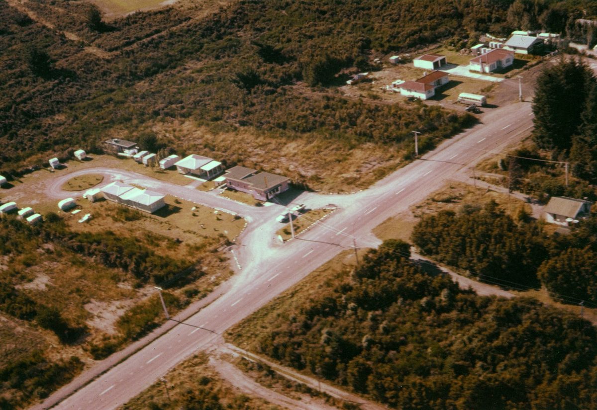
 Taylors Camp on Taupahi Road which was the main north/south road back then. The Tongariro River Island Pool is clearly seen to the east.
This Taylors Camp land was recently subdivided for residential sites. The ROW house sites sold for $250,000 each, river frontage for far more, and some are now back on the market at higher asking prices.
 Taylors Camp is where all the “fishy dignitaries” stayed (before TRM was developed). These included various GG’s such as Admiral of the Fleet, Lord Jellicoe, second Governor General of New Zealand, 1920 – 1924. It is recalled that when staying at Taylor’s lodge, Lord Jellicoe used to leave quietly without saying where he was going and would return with plenty of fish. It was found that he caught most of them below the old Ministry of Works quarry. Joe Frost (well known local resident angler) recalls him as a very good angler and very friendly. One day when Lord Jellicoe forgot his lunch, he shared Joe’s a cup of tea from his billy.
 But did you know TRM also had its share of well known dignitaries too… As they are still alive we daren’t remind them.
Next on right is the old Fletchers Mill. Turangi township now occupies the scrubby land in the foreground. The extent of the mill is quite surprising when all that remains now are a few grazing paddocks in Grace Road – to the north of Turangi and the Tongariro River.
 This must have been the main local employer back then before Turangi township was developed with most of the labour force sourced from Tokaanu.
The remaining images are historic pics from Facebook.

The pre-European Tokaanu before the village was developed.
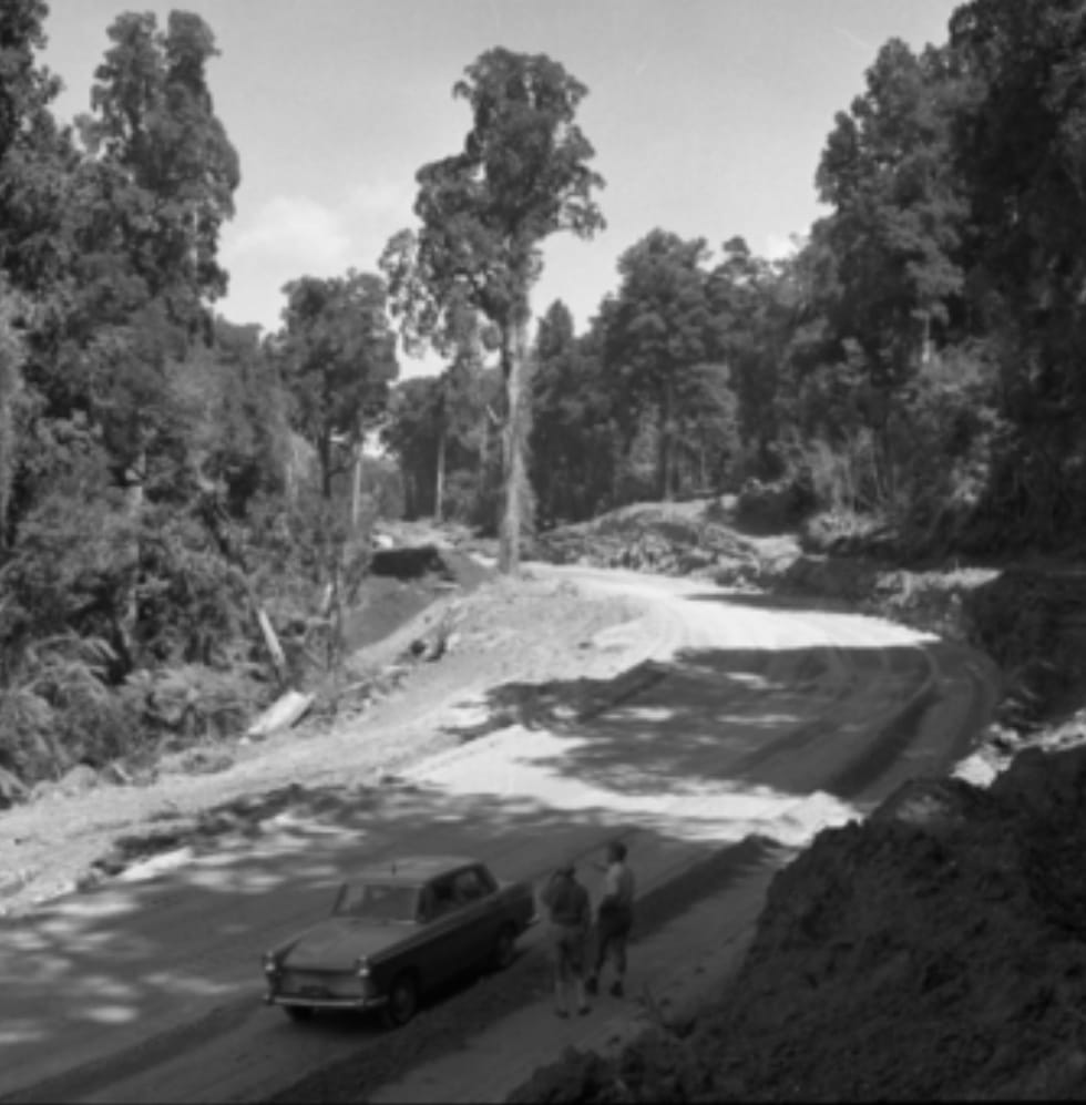 The Te Ponanga Road being developed between SH41 next to the Tokaanu Power Station tail race, over the hill to link with Lake Rotoaira. At a guess this would be 1960’s?
This route followed old Maori trails and is now the main road from Turangi to National Park mainly used by skiers on their way to Whakapapa.
It is also favoured by anglers on their way to Lake Otamangakau – our trophy lake.
 Taupo main street was in 1949.
The commercial development all looked more relaxed back then.
The petrol was cheaper too.
 To qualify for a fishing report – this 1937 image is on the lower Tongariro.
Compare the size of the trout then…
They look more like fat salmon.
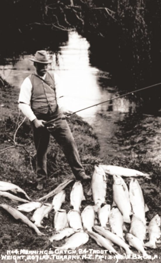 The inscription on the old photo reads “A mornings catch from Tokaanu – 24 trout weighed in at 207 pound…