We love to meet “new Turangians” who have chosen to move from Auckland to Turangi – two more this week. Both anglers! They have prioritised their family lifestyle choices to prefer the more important things in life, swapping traffic congestion, endless queues, and increased stress levels for the slower, relaxed, easy small-town life. They are still adjusting to a town with no traffic lights, no congestion and keep reminding us “We don’t know how lucky we are”…
Anyway, they were very interested in local history and recent changes in Turangi, so I promised to repeat an earlier blog with old maps and photos to compare – as follows:
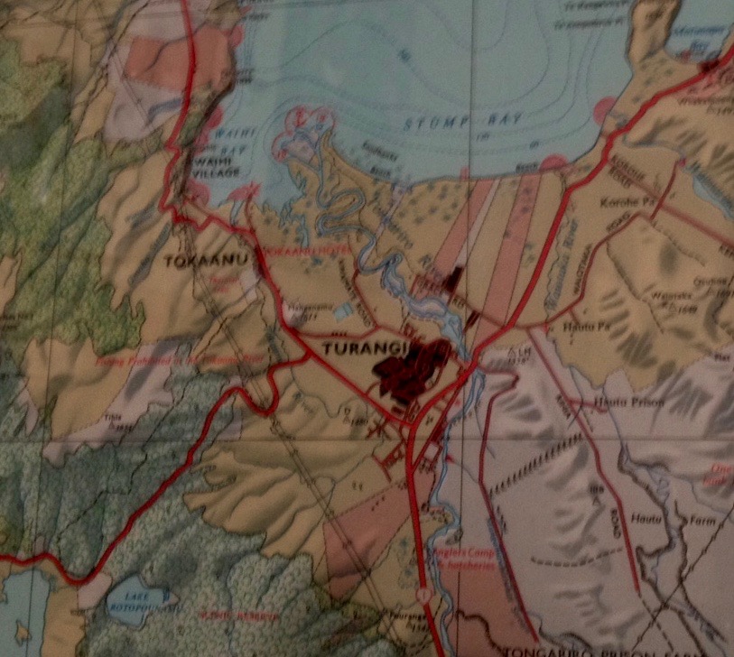
1955 Turangi map – spot any differences?
Recent historical photos stirred up lots of interesting comments from fishy inmates so here are some old survey maps to remind anglers of the “good ol’ days”.

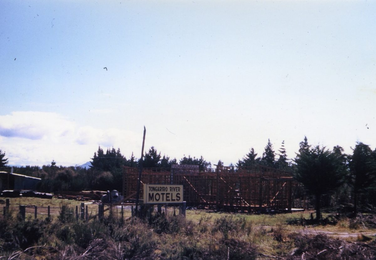
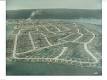
Above is a 1960 aerial (photo taken from the open cockpit of a Tiger Moth!) view of Taupahi Road and Tongariro River Motel… It was developed as more of a caravan park for anglers with a village shop at the front (now Units 1 & 2).
Taupahi Road was the main north-south road.
There was no Piri Road (previously known as Link Road) or SH1 at rear.
What is now Te Aho Road leading to Judges Pool was just a pumice residential drive.

The photo of the grader above was forming SH1 immediately on the back boundary of TRM.
Turangi township did not exist at all. The other lake edge settlements of Omori, (Kuratau had not been developed) Motuoapa, Te Rangiita (Tauranga Taupo River) and Waitetoko (Mission Bay) were all larger than Turangi.
There was no ‘Trout Centre’ as such, but there was an anglers camp on the edge of the Tongariro River north of where the trout centre has now been developed.
Vehicle access extended beyond the end of Grace Road all the way to the Tongariro delta, where there was an anglers’ camp.
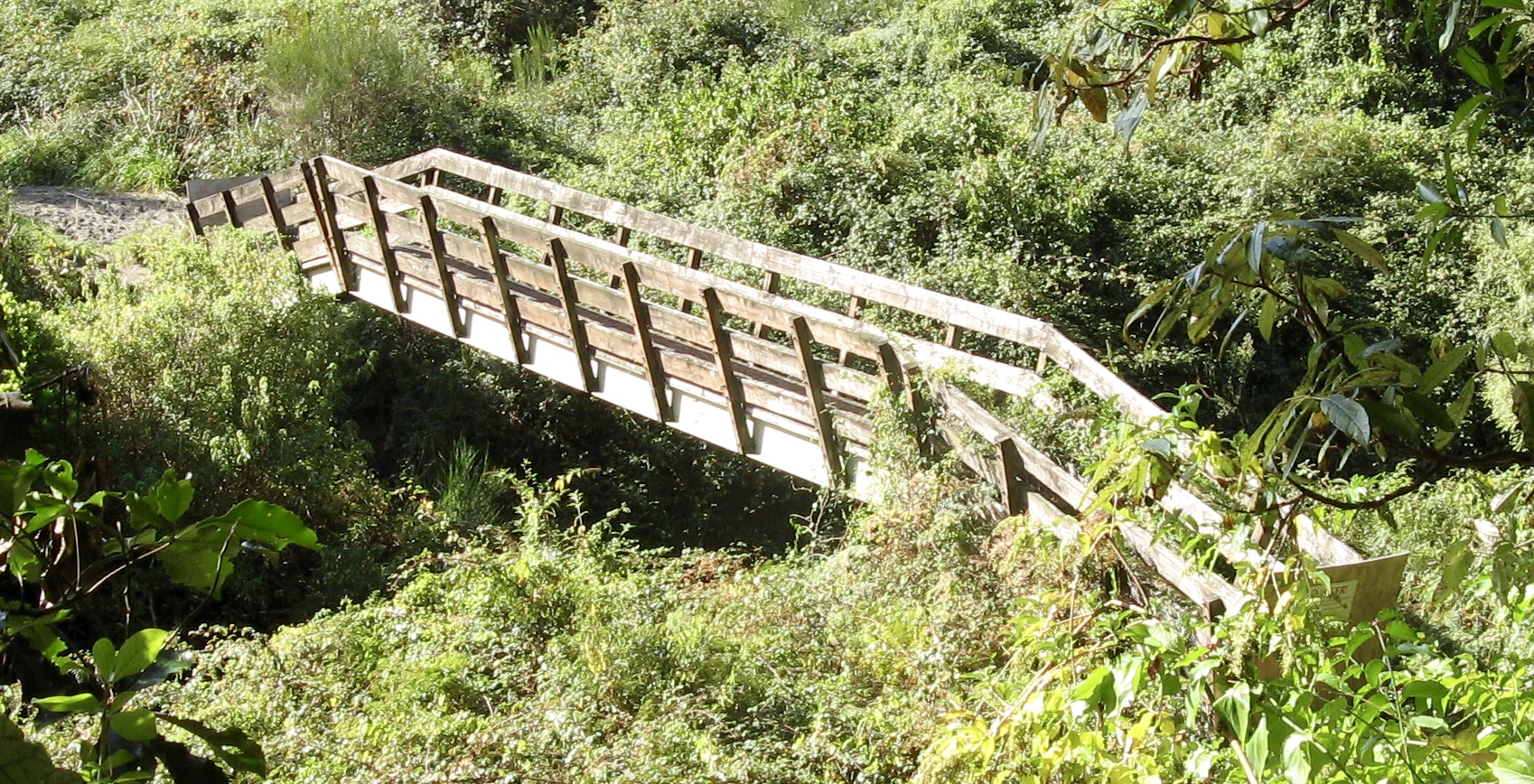
There was no anglers’ access road up to the Blue Pool and the road bridge over the Poutu Stream – draining Lake Rotoaira was further north. The bridge below provided anglers’ access across the Poutu Stream. It has since been removed.
Then ‘Uncle” MOW (Ministry of Works) arrived with their bulldozers and graders.


The old survey maps may be of interest to anglers as above it shows Turangi as it was in 1955 (about when I first fished the Tongariro River…).
It was just a name for the intersection in 1955 – there was no Turangi town. The settlement was known as Taupahi. The main road was River Road – the north-south road outside Tongariro River Motel.
The only suburban streets were those connecting to the Tongariro River beside the Breakfast Pool.

Next to the Tongariro River Bridge was the fishing lodge, three shops and the bus sheds serving the local school. Fletchers’ Mill was located on Grace Road.
The main road connecting the much larger settlement of Tokaanu (and Waihi Village) was Hirangi Road (now located on the northwestern side of the town boundary).
There was no SH 41 and no Tokaanu power station tail race – indeed, there was no power station and no Saddle Road – SH47 – connecting Lake Otamangakau, which was then just low-lying swamp land at the head of the Wanganui River (No “h” back then either).

There were various “Fishing Lodges” with the main anglers’ retreat being Taylors Lodge (below) frequented by various Governors General since the 1920’s. Tongariro River Motel was the first motel.
There were various other fishing lodges including one up the Waiotaka River in the Hautu Prison.

Following the interest in the 1955 map of Turangi we now move forward to 1963…
Spot the differences…

In 1963 there was still no Turangi town. Turangi was still just an intersection on the main north-south road. The Te Ponanga Saddle road (now known as SH 47) had not been built.
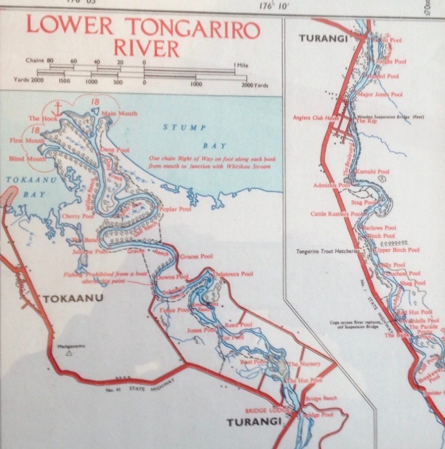
An anglers camp was located on the main road north of the ‘Tongariro Trout Hatchery’. Some of the names of the upper Tongariro Fishing Pools (which have now disappeared) included Dreadnought Reach, Bank Pool, Breakaway Pool, The Parade, Gentlemen’s Pool, The Racecourse, Gun Club Reach, etc. This shows how much the river has changed.
Back then the lower river pools were just as important – with access by boat from Tokaanu – including Dans Pool, Willow Reach, Cherry Pool, Poplar Pool, Gull Reach, Jellicoe Pool, Graces Pool, Downs Pool, Toi Pool, Boat Pool, The Nursery, The Hut Pool (which referred to the anglers huts at Bridge Lodge). Most of these are now gone or changed. The lower river is now deserted apart from the occasional boat in Summer.
The 1963 & 1967 maps also noted the wooden suspension anglers access bridge below ‘The Rip’.
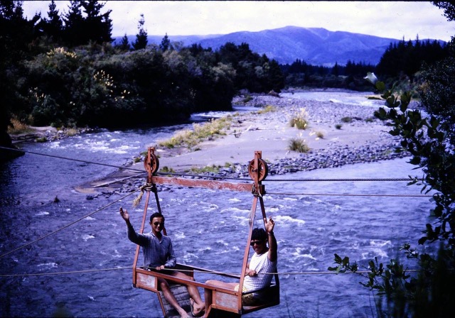
To cross over at Red Hut was a flying-fox to replace the old suspension bridge washed out by flooding in 1958. The river contour has changed completely since.
Then move further forward to 1967…below. Turangi township – via Uncle MOW (Ministry of Works) – has arrived! A city of the future?
Note the Tokaanu Power Station tail race had still not been excavated.
SH 41 & 47 (known as the Saddle Road) were completed. Turangi’s suburban street pattern was evident – even if it was not completely developed.
SH1 had been developed to bypass Taupahi Road. The prison farm roads were completed. Exciting times for a new town.

Then above is the 1978 map which is much as it is today. Note there was a road link connection from Turangi township to SH1 past the school at the northern end of town which is now blocked off.
By then the tail race from the Tokaanu Power Station was completed. A tourist brochure writing about Turangi back then advised:
The New Town
“Construction on the power development and the new town began late in 1964. Progress was rapid and a boom town atmosphere was created. By May 1966, the population of Turangi had jumped from 500 to 2,500 people and by 1968 the resident population reached a high of about 6,500. The rural countryside to the west of the old Turangi village was rapidly transformed into an urban landscape. Even today, the township still bears the distinctive marks of the Ministry of Works planners and the Government who invested $16 million in the development. A model town with curving streets and cul-de-sacs, uniform houses, a pedestrian shopping centre, parking lots, and separation from the traffic on the main highway was created. Following the withdrawal of the Ministry of Works, after the power scheme was completed in 1985, the Turangi/Tongariro area has been through a period of retrenchment.”

By the late 1990’s the town had entered a new era, having consolidated and diversified as a tourism and service centre for the southern end of Lake Taupo. Today, tourism and forestry are the mainstay of the community with the Justice Department prison, the Electricity Corporation of New Zealand, and forestry being the main employers. In the years since 1964, the appearance of Turangi has mellowed and thousands of trees had grown to maturity. In spring, the roads are lined with cherry blossom and in autumn the leaves are beautiful. Project homes have changed to private ownership and many have been modified.

More than 30 years on, Turangi has evolved into a more settled community but retains a distinctive character shaped by the power project’s physical and economic domination. The prediction made in the mid-60’s that ‘Turangi will become a centre for farmers, tourism, forestry, fishing and hunting and the holiday trade in general’ has struggled to come true. Post-power scheme population estimates were also near the mark, with Turangi’s current population back then being just over 4,000 people. As there was no land available for expansion in Turangi, most new residential development occurred out of town at Motuoapa or Kuratau.

Now in 2026 Turangi’s resident population has continued to shrink to just over 3,000.
Turangi desperately needs help. For direct comparison, consider Twizel, which was the next 1960’s Government ‘Think Big’ hydro-electric development town, where the entire development was designed on a “temporary” basis. Relatively, compared to Turangi on SH1, the remote location had little to support anything permanent.
The relative location was far more remote on SH8 in the McKenzie District, the nearest towns being Timaru to the north-east, 160km (2 hours drive time via Burkes Pass), or Cromwell to the south, 140 km (1 hour 41 min). Comparatively, the weather pattern was more extreme. The (ticky-tacky little boxes) housing were designed as low cost basic temporary accommodation only. There were no footpaths or curbed roading. Yet at the end of the Upper Waitaki hydropower construction, the demand for accommodation from anglers encouraged the Government to sell off the housing stock as both holiday homes and permanent accommodation. Since then Twizel has continued to flourish and grow.
If Turangi is to survive the future and flourish, it needs a more positive direction. Fishy inmates, who have been regular visitors at TRM for many years, have suggested that real leadership is needed to provide more effective local tourism promotion and better management of the ample tourism resources. How can it happen?
Please send your suggestions and ideas to Taupo Council.
info@taupo.govt.nz
They need your help!
