What a wonderful variety of lakes easily accessible from Turangi.

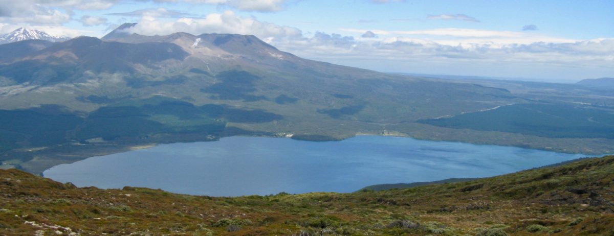
 View looking west from the summit of Mt. Pihanga over one of our special hidden lakes – Lake Rotopounamu – accessed off SH47 on the way to Tongariro National Park .
Lake Rotoaira is off to the left just out of the picture. In the distance you might just identify the outlet of Lake Otamangakau – more on that below.
From SH47 a well formed track provides a popular walking circuit around the lake taking about 2 hours. The beach hidden in the foreground is ideal for swimming.
 You will note Rotopounamu has no stream outlet. The drainage apparently seeps through the pumice filter system to emerge near Turangi for our water supply.
The small green “Emerald” lakes on right beyond Kiki are on the Tongariro Alpine Crossing – NZ’s most popular one day walk (19km). Due to severe crowding – as indicated on right – and parking issues it is now only recommended by SWMBO during week days… Don’t even think about it over Easter holidays – a better option is to ask SWMBO for TRM’s alternative one day trail programme which is even better – with more lakes and waterfalls and rivers and even better views.
 Lake Rotoaira is one of the few privately owned lakes in New Zealand being administered by the Lake Rotoaira Trust on behalf of its owners. It covers an area of 13 km². An access permit must be held by those using the lake for fishing and similar activities. It is naturally drained by the Poutu Stream into the Tongariro River.
The Tongariro Power Scheme utilises Rotoaira as a storage lake for the Tokaanu Hydropower Station. Extensive engineering works were carried out including the diversion of a number of other streams (including Whanganui River) into Rotoaira via the Otamangakau Hydro Lake and construction of a tunnel through Pihanga to the Tokaanu Power Station. (This tunnel has recently been closed for inspection) Damming of the Poutu outlet has created Motuopuhi island, formerly a peninsula.

 View looking south from the summit of Mt. Pihanga – Lake Rotoaira in foreground with Tongariro National Park beyond where the Tongariro Crossing emerges down to SH 46.
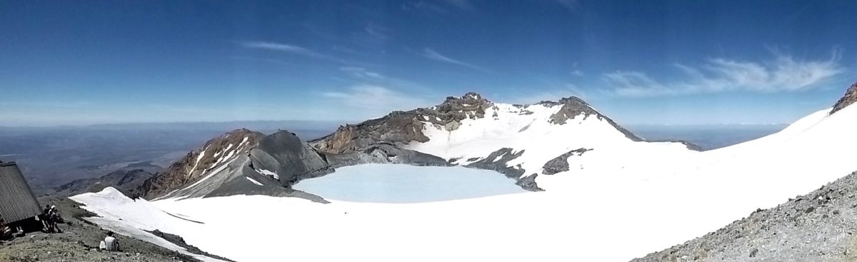
The snowy peak of Mt. Ruapehu can just be seen on the left above where there is another little hidden lake that is rarely seen – unless you climb Mt. Ruapehu (only 9 km from the top of the chair lifts.)
![]()
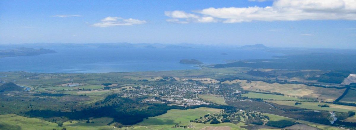 Looking north from the summit of Mt. Pihanga is Lake Taupo with a cute little tourist town perfectly located in the foreground next to the winding Tongariro River on the right – aka Heaven…


 Above is an interesting cloud formation over Tongariro National Park with the eastern end of Lake Rotoaira in the foreground right.
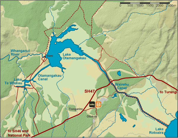
Then on left is another elevated view of Lake Taupo and on right is a map of Lake Otamangakau – a hydro storage lake with images below
Lake “O” is one of the most popular ‘trophy’ trout fisheries in NZ. located off SH47.
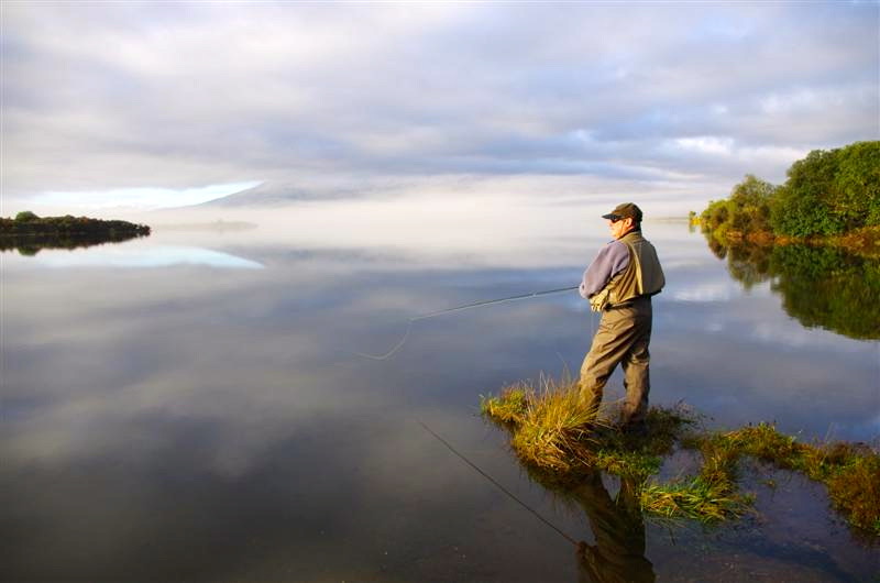
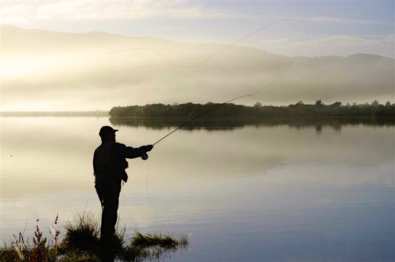 Lake O was previously a large swamp at the head of Wanganui River and now mainly visited for BIG trout. It is already world famous.
The silky images on Lake O were taken by an Australian inmate who was supposed to be fishing but was carried away by the photogenic beauty and charm of the remote lake…
So many lakes…. we didn’t even get to show you Lake Kuratau as some fishy inmates want that to be kept secret…
