A BIG weekend report so make a cup of tea. It includes previous reports back to 2005. Note the 2018 report warned of this “river about to happen” and explained the loss of the Breakaway Pool in 2004.
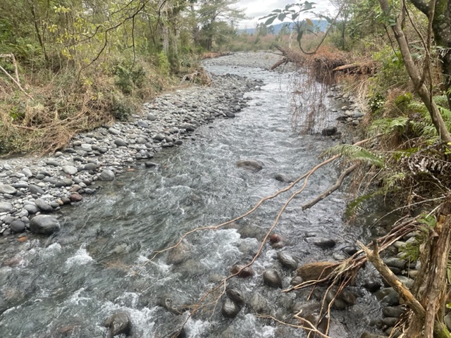
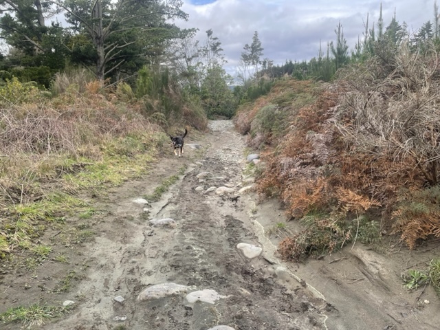
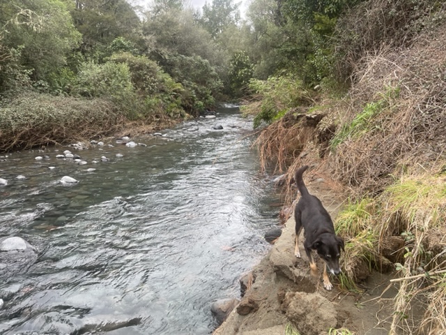
.Recognise this fishy stream? Photos taken yesterday are a new bypass stream with sufficient flow velocity and energy to try to qualify as a river, that has appeared since the flood last week. It is anticipated by some anglers that with successive floods, this will gradually gouge out deeper and soon become the main river from below the Cliff Pool to emerge in the Poutu Stream above the Poutu Pool. Confused? Read on…
First some history:
From NIWA report for Environment Waikato in 2005:
The Higher Lower Tongariro
Changes in position of river channels
A comparison of aerial photos taken in June 1958 (after the large flood) and December 1984 allows identification of changes in the river position over that period… From Sand Pool to Breakaway Pool, 1.5 km downstream, the river scoured its left bank and moved some 20-30 m in a south-west direction towards SH1. For the next 1.5 km from the Breakaway Pool to Red Hut the river eroded its right banking moved a similar distance to the north-east. It reformed an old 800 metre long shortcut from Poutu Pool to the footbridge upstream of Red Hut Pool creating a 300 m wide island. This “new” shortcut was the main channel of the river back in the 1920’s. etc…
TRM have been watching this for some time. The likelihood of a break-out even featured in a TRM blog which anticipated that above Boulder Reach Pool the river which was just slightly higher than the boulder bank along the TLB, was about to burst through and follow the walking track towards Poutu Pool.
For the last few years the existing walking track to Boulder Reach became a shallow stream during floods. The track down river to Poutu Pool was similarly gouged out whenever the river over-flowed above Boulder Reach.
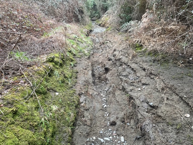
Now the new shortcut stream has moved north-east parallel with the walking track.
The access track along the edge is in danger of slipping in so some bush bashing may be necessary.
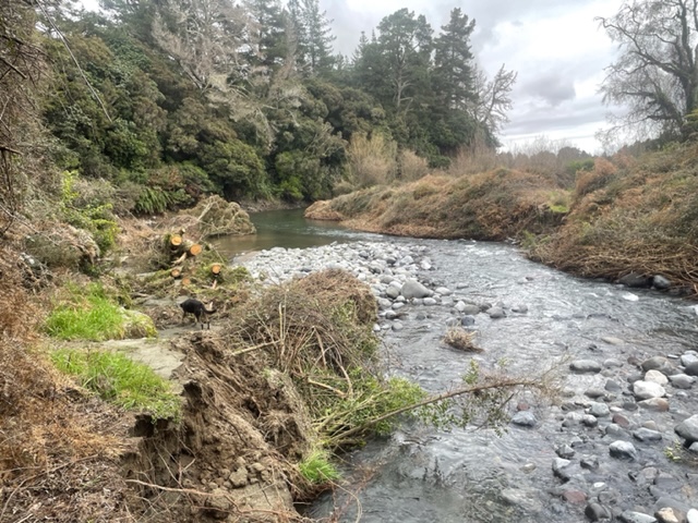
This new river has cut through the old track and needs to be waded to get across to the old track leading to the Poutu Pool at the confluence.
The new course does not reach the main river but breaks through onto the Poutu Stream about fifty metres above the main Tongariro confluence.
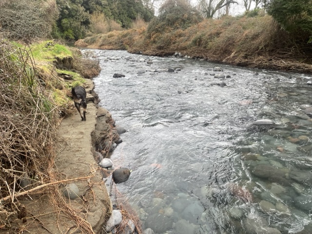
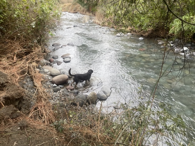
Looking back up the poutu Stream still overgrown but wadeable.
Once this settles it should provide easy wading with somedelightful dry fly action in summer months.
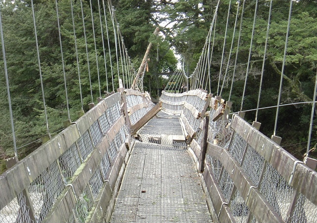
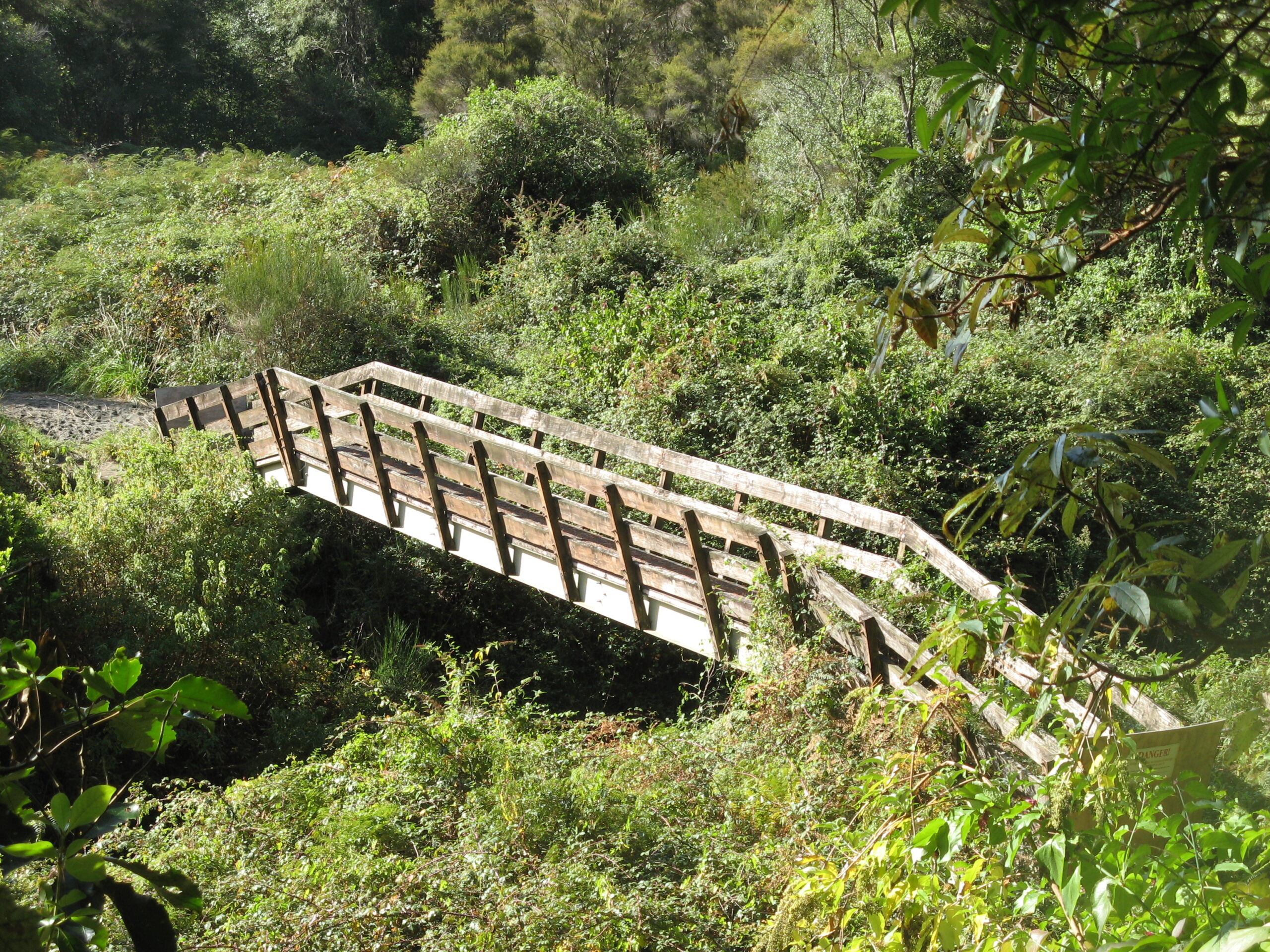
Now for some real history – this was the original anglers access bridge across the Poutu from SH1 to join the track to the confluence with the Tongariro or to provide access up river to the Breakaway Pool. Photo was taken from the olld SH1 in 2007 when the bridge was blocked off and track overgrown as anglers could drive up to Big Benad, Boulder, Blue, Sand, Whitikau or Fence Pools. DOC removed the bridge which is now somewhere up in the Tongariro National Park.
Previous reports on Boulder Reach by TRM – note anglers were warned about this river “waiting to happen” after the 700+ cumec flood in 2018.
Boulder Reach
After the flood last January, TRM updated a number of pool reports including Boulder Reach. At the same time, the older reports are repeated so that anglers will be aware of changes.

Boulder Reach – August 2005
Damn, what can anglers do when the carefully selected pool is already occupied?

Take, for example, Boulder Reach – it must be one of the most popular pools on the Tongariro River. Boulder Reach was reformed by nature as partial compensation for the loss of the Breakaway Pool after the Tongariro flood in 2004.
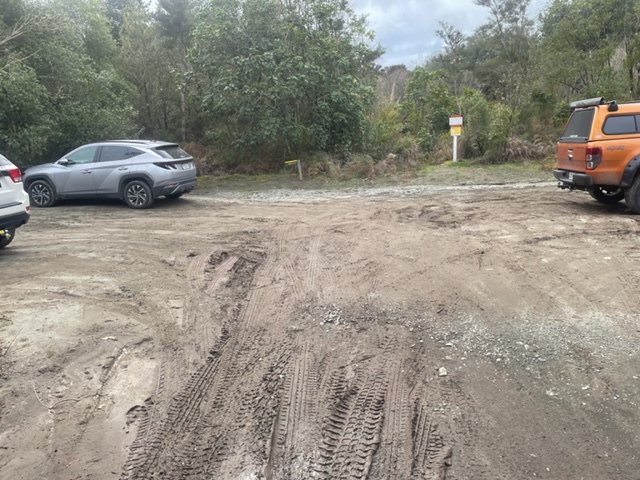
Car access is through Justice Department land after crossing the Poutu River, 7 km south of Tongariro River Motel or from Turangi shopping centre. Then after about 1 km., veer left down towards the Boulder Reach car park.

Park at the T junction where the original vehicle access has now been washed out. The track to the left leads to the confluence of the Poutu Stream. The track to the right leads to Boulder Reach.
For safety reasons in these reports we always prefer the Red Hut Bridge to cross over as the Tongariro is subject to rapid increases in volume without warning.

For Boulder Reach, follow the walking track leading down the LHS for 5 minutes to this delightful nymphing pool. This will take about 3 rods comfortably although up to 5 are often squeezed in.
If you are first – you will need to be early – make sure the shallows are fully covered first. This pool produces through the full length.
Wading is easy – only knee deep to cover the main lies. It is fishable from either side although the true LHS appears to be the favoured side. Usual ammunition is a standard Tongariro nymphing rig – weighted hare & copper bomb with a smaller, say size 12-14 bead head half back or pheasant tail or prince nymph patterns. If they do not work, try glo bugs.
Traces need to be over a rod length but it is not deep or fast. It has been described as an optimal nymphing pool, ideal for training muscle memory for perfecting your casting.
The current is even and not too fast for mending practice to achieve a natural drift. Perhaps that is why it is targeted so often by professional guides. Even my cast looks good on this pool.
It seems so basic – nymphing for dummies – spoilt only by everyone else targeting this pool too. There are other options, if you arrive to find a traffic jam:-
Cross over (take wading pole in case) below the Cliff and fish Boulder Reach from RHS;
Cross over and stalk the Cliff Pool – keep a low profile so as not to spook trout lying deep;
After crossing head up river to Fan and Boulder Pools – a 20 minute cross country tramp;
Return to carpark, head left 10 minutes to Poutu confluence – again longer leader needed;
Wade up the Poutu? Popular after rain as this tributary from Lake Rotoaira remains clear;
Continue on to Blue Pool, Sand Pool, Big Bend, Boulder Pool, wherever the crowd isn’t.
Boulder Reach Pool 2006

Boulder Reach pool is generally unchanged from 2005. It is probably the most popular pool in the upper river. This is still a top-holding pool where most anglers stand in the lie and fish the top and tail of the main current although fish are found in most places throughout the pool. If you are first into the pool on the LHS make sure you fish your feet first as the trout rest in the shallows along the LHS. You hardly need to get your waders wet. Later on, the usual enthusiastic angler pressure, testing their chest waders forces them all out towards the central gut.
The foot access from the car-park has deteriorated further from flooding. DoC has now formed a walking track to the pool through the small side stream rather than down the previous road leading to the Cliff Pool.

These pool reports have been entirely based on various comments and feedback from anglers/guests at Tongariro River Motel. By and large, they modestly claim to be the best fly fishers in New Zealand. From these accurate reliable reports, we have a hung jury on which side of Boulder Reach is best – a 50/50 call.
Boulder Reach can be crossed towards the tail, usually being about crutch to waist deep if you find the right crossing, but we recommend a buddy to hang on to, or stout wading poles, or both. Note the crossing is also the lower holding area, so if you are brave enough, try to cast ahead as you cross. You may need a net if you want to land it as well.
Once you have made it to the RHS, you can also continue further up the river into no-man’s land to check out the following – also covered in the 2005 report.
1 Check the small swirly pool below the Cliff and bypass,
2 Check out the by-pass into the narrow gut,
3 Check the Cliff Pool, cast from the shelf at the top of the pool,
4 Check the new no-name pool above where the by-pass leads from the main river.
For nymph fishing each of these, review the leader length and weighted natural at each spot. If the river is clear, small natural patterns are reported to be more successful.
Alternatively, if you are like me and don’t like wading, you can access the RHS by crossing the Red Hut Bridge.
From the Red Hut car park cross the swingbridge and take the fork to the right – upriver. After three minutes you will descend down a dug-out staircase to the sound of tuis and bellbirds to emerge in a grotto with stunning native trees and fauna.
Veer off to the left-hand track at the base of the steps. (The right track leads across the bypass to Poutu Pool) Then take time to enjoy a delightful stroll along the bypass. Lookout for trout in the bypass. A few years ago fishing the bypass was frowned upon to avoid upsetting the spawning redds, but subsequent floods have dealt with these. Have a peep from the high cliff and have a flick where the bypass flow narrows and hits the cliff – there are often hungry trout watching underneath – in summer as well as winter.
Hint – During the winter spawning season, glo bugs appear to work better in the lower river but as you proceed further up – to Boulder Reach – the trout have become more river educated and start looking for natural bugs.
Well, so we are told…although no one has interviewed the trout about this, yet…
Boulder Reach access & a river waiting to happen

Above is Waddells Pool (no changes) and below is Poutu Pools reported on yesterday:


Following the updates on Poutu and Waddells Pools today’s report is Boulder Reach.
The main changes to Boulder Reach are more to do with the anglers access.
The pleasant walk – waddle in waders – stroll from the car park now involves crossing a wash-out.
This has been such a pleasant bush walk for so long it was a surprise to see the extent of the damage.
We always enjoyed looking out for native pigeons roosting in the tops of the more mature trees and Manuka. Some were so fat from eating berries they could hardly fly.
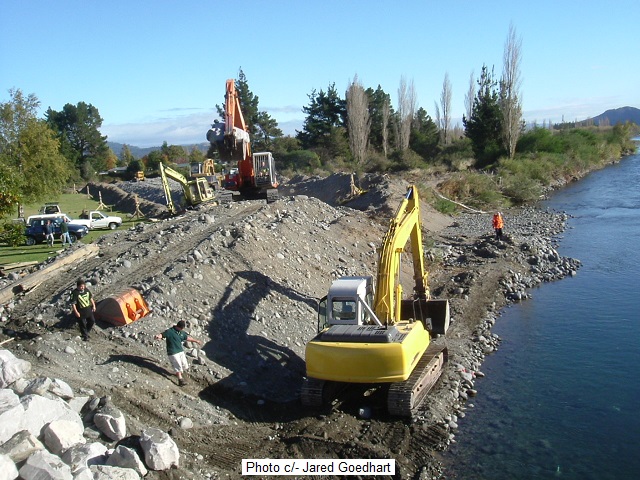
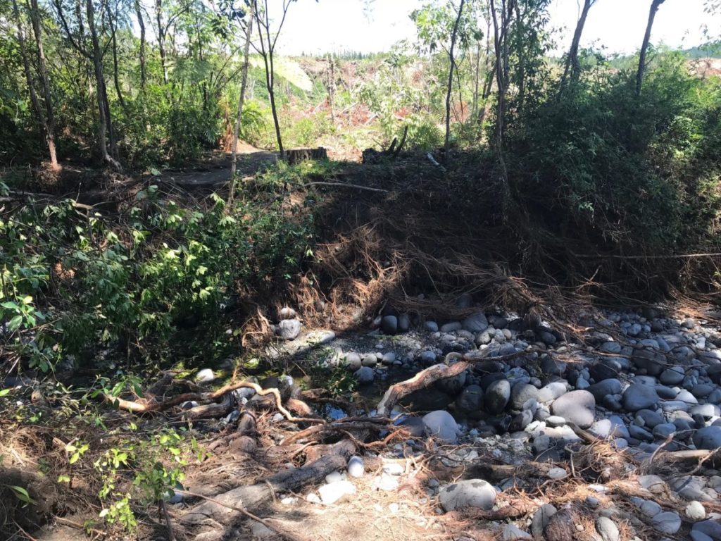
The old dry creek bed overflow from below Big Bend was flushed out by the recent 700+ flood. This has added to the walking difficulty along the track to Boulder Reach.
You might need a wading pole just to get there…

The images may not adequately portray the extent of the washed-out track but the climb down and out again is now more difficult for those older anglers – so you are warned…
On right you can see the impact of the “hydraulic bulldozer” which has re-created the old river bed.
Now the boulder bed of the over-flow, which used to have such famous pools as the old Breakaway about twenty years ago, looks like a river waiting to happen.
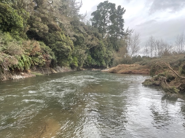
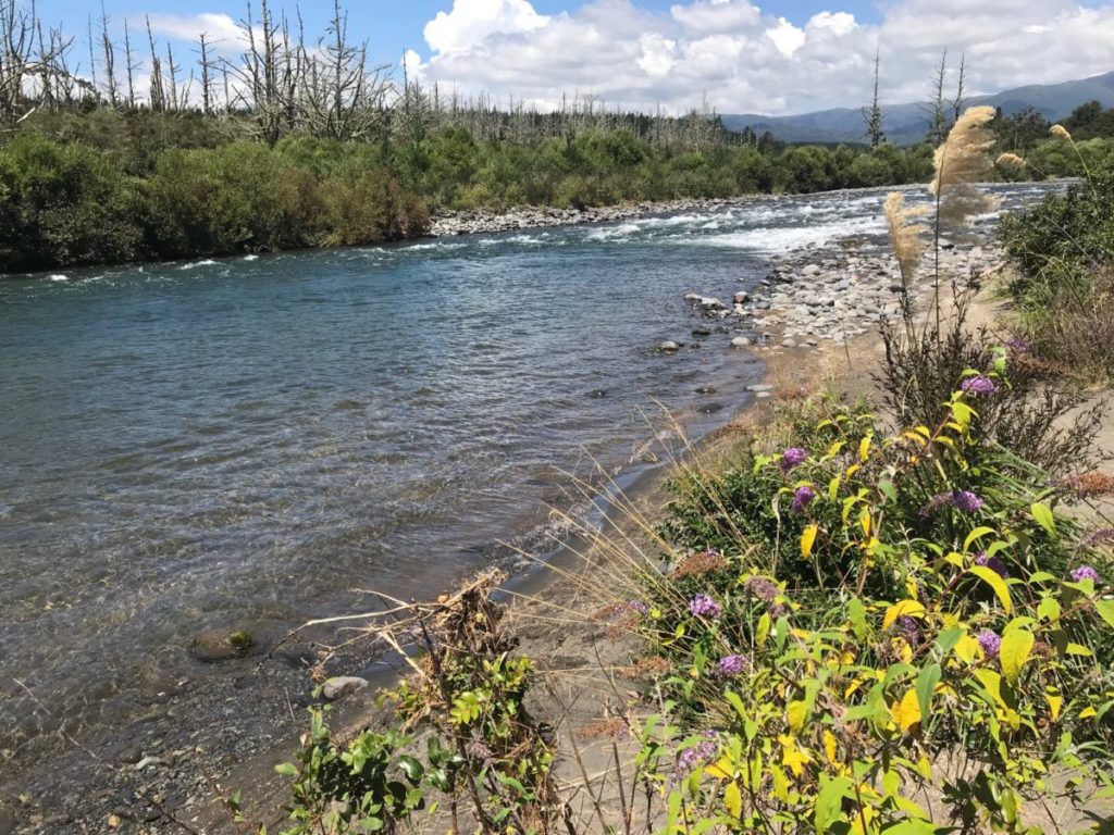
Then on to the Boulder Reach itself. The TLB has been subject to the arrival of a sandbank which has moved down river to make wading much easier.
Anglers can now safely wade out directly from where the track joins the river, to cast into the seam of the main flow.
It may be just as well as the bubble line from the main flow has moved well over to the TRB.

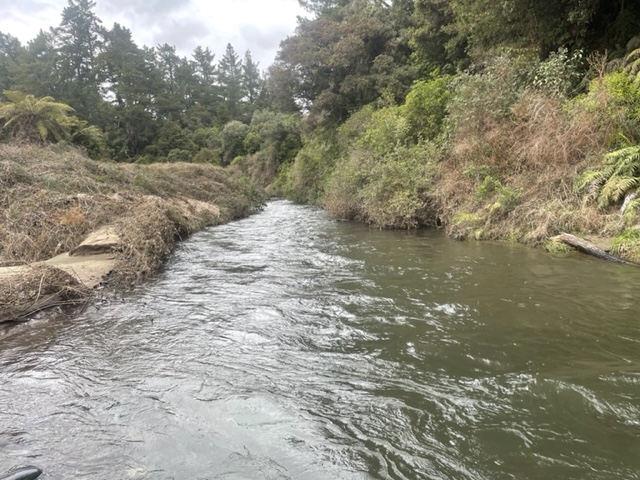
The “new beach” should be evident in the images. Usually such sand is detrimental to fishing prospects as it covers the stony pebble river bed which supported most of the trout food – caddis etc. so there is a downside. The sand is a mixture of pumice and toxic ash. Trout usually hate it.
However during our inspection, two good-sized Rainbows were easily spotted casually cruising up and down the sand bank – possibly searching for their previous food source.

The access road in from the Blue Pool Road and the car park have been improved also – see photos from the report yesterday (26 January) on Poutu Pool.
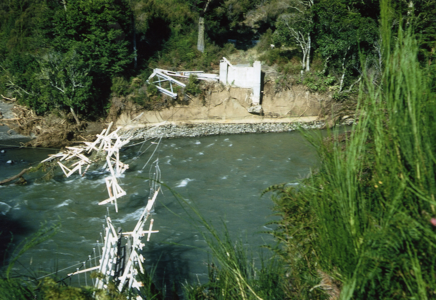
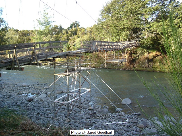
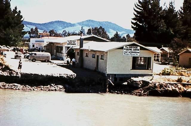
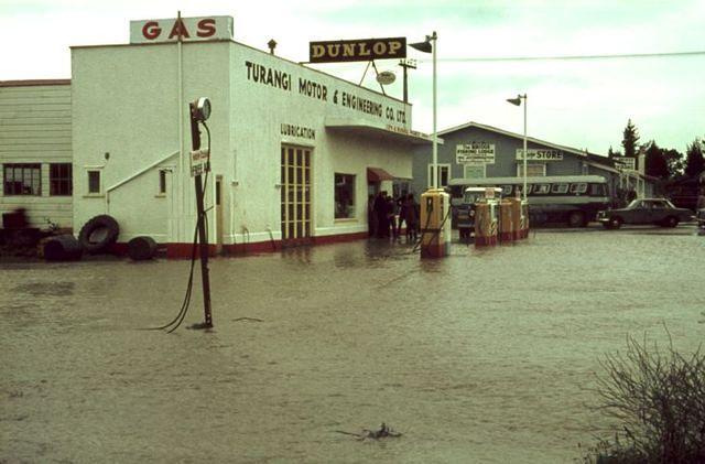
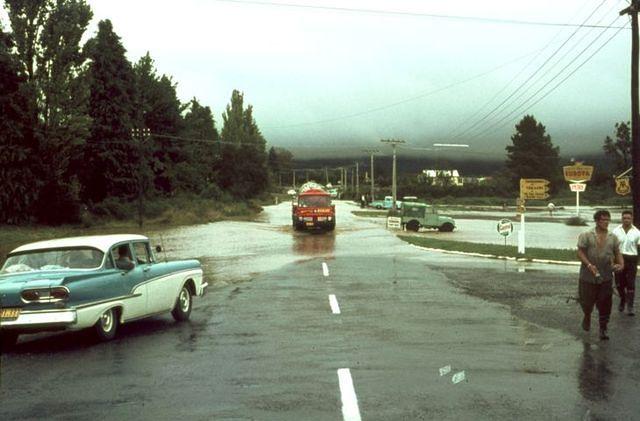
Some more Tongariro flood history:
To indicate how we got off lightly this time, below are some random photos of previous Tongariro flood damage…