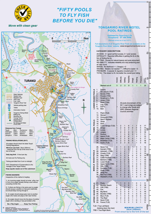
As TRM’s map – Fifty Pools to Fly Fish Before You Die – is being revised and updated, we have been asked where some of the pool names came from. They are all historical with various maps used for reference.
There is so much rich history surrounding the Tongariro River pools that are in danger of slipping away unless it is recorded by tourist information panels along the Tongariro River Trail.
TRM have moaned about this before but – so far – has not been able to gain approval from Councils (Taupo District Council or Waikato Regional Council), or from DOC (and their treaty partners?).
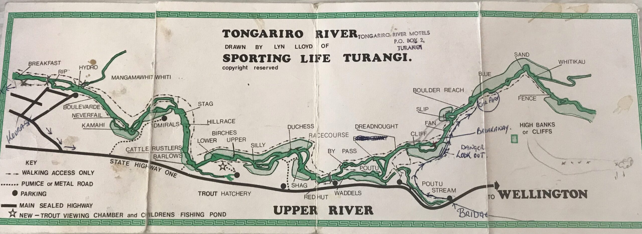
Below are two of what we think are the most important “reference” maps, dated 1928 and 1974, from the 1975 booklet by Allan & Barbara Cooper. Originally the town was known as “Taupahi”.
Many locals suggest the old historic (“Trout Fishing Capital of the World”) name should be restored for the original town on the eastern side of SH1.
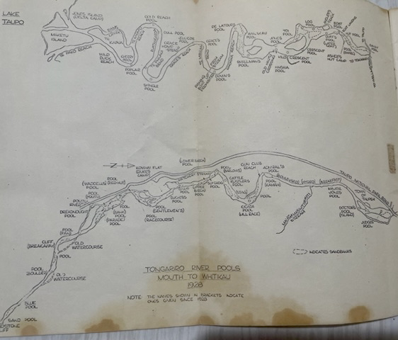
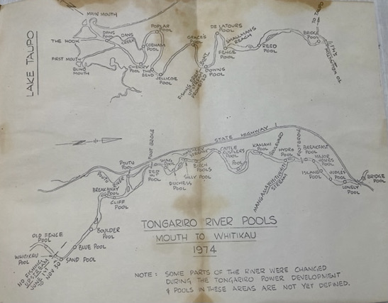
Many pools have come and gone (Dreadnought Pool, Breakaway Pool, De Latours, etc.) and moved away or even shifted sides from their original location. Some more recent inventions are not mentioned on any of the historical maps. Below Reed Pool most have sadly eroded away and are rarely referred to or they change with every flood due to silting up and are now unrecognisable.
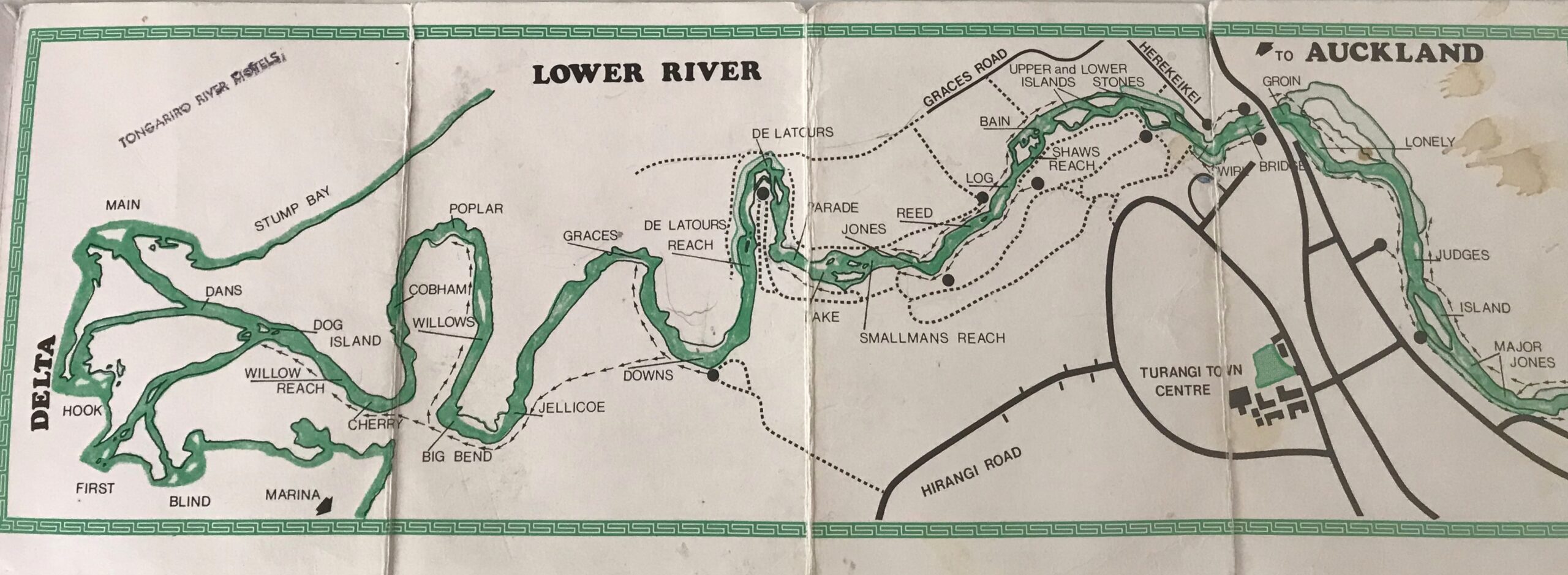
Others include the historical map drawn by Lyn Lloyd of Sporting Life tackle shop – after the new town of Turangi had been established – and various books on the Tongariro include maps.
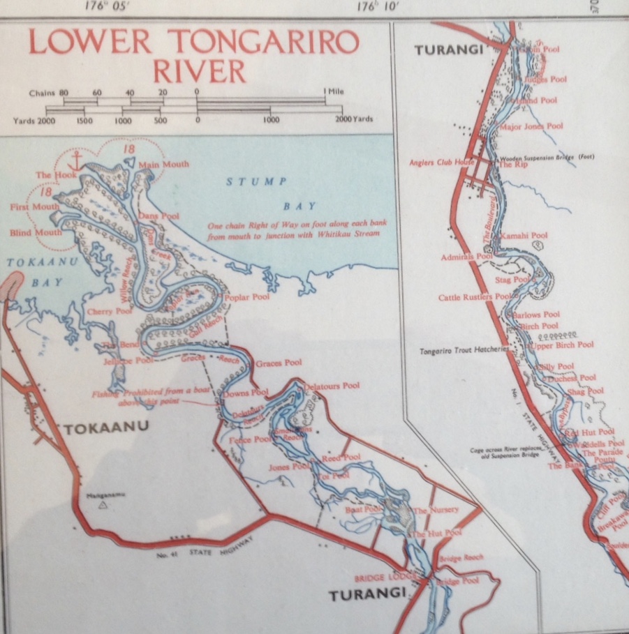
Note the official Government declaration which is still applicable:
“One chain Right of Way on foot along each bank from mouth to junction with Whitikau Stream”.
(Interpretation for young anglers: One chain – previously referred to as the Queen’s chain, is 66 feet or just over 20 metres or the width of a road.)