This post will be of interest to everyone who uses the Tongariro River trails for biking, birding, exercise, dog walking, whatever – not just trout fishos. I doubt if there are any other trout rivers in NZ that can boast one hundred years of dispute over the names of pools on so many fishing maps. The official maps are from DOC (Department of Conservation), who maintain the trails and is the Taupo Fishery Managers.

A recent TRM blog mentioned recent changes to the lower Tongariro River Pools. This immediately generated more interest in the history of changes to the river geography and readers’ questions requesting more info about many forgotten fishing pools. Over the years, the names of many pools have changed as the pools themselves physically moved or were destroyed after floods.
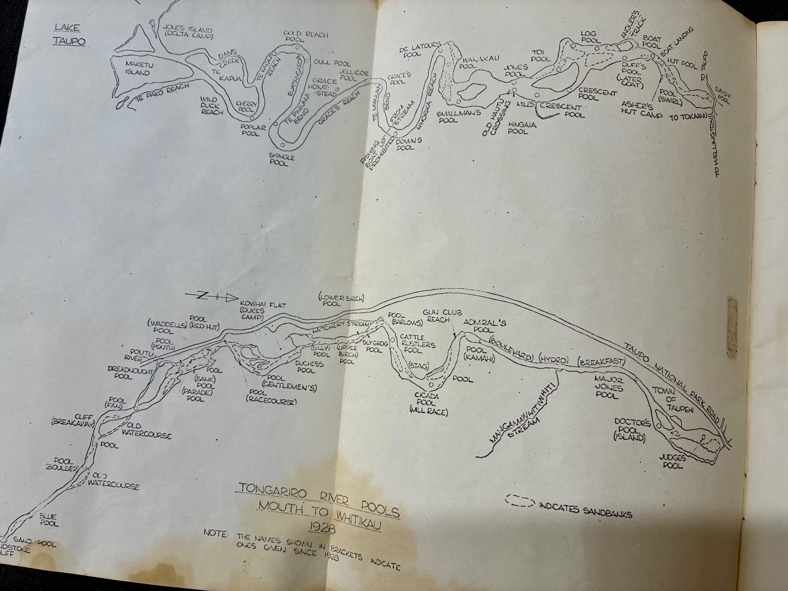
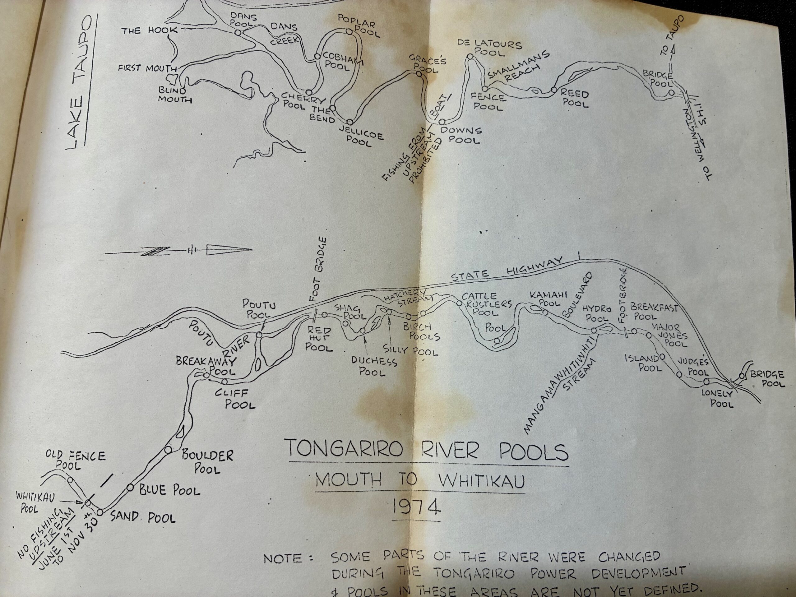
TRM’s historic reference maps commence in 1928 with Morilleau’s survey map after the ownership or title to the bed of the river had been passed on to the Crown. This was included in the booklet “POOLS OF THE TONGARIRO by Allan and Barbara Cooper published by the Turangi District Historical Society in 1975.
(Since then, about fifteen years ago, there was another change in ownership. The local Maori tribe, Tuwharetoa, have been reminding everyone recently claiming that they own Lake Taupo as well. There is much pent-up passion and legal history involved in these tenure issues. Last Friday the Taupo Council held a public meeting to consider the JMA [Joint Management Agreement] but any decision has been postponed until after the local authority elections in October. Apparently, by law, there has to be a JMA with Tūwharetoa Māori Trust Board for the Upper Waikato River. At the request of Tūwharetoa Māori Trust Board, the draft JMA has been extended to cover Lake Taupō and its tributaries. The main “tributary” to Lake Taupo is the Tongariro River. Watch this space…)
The old Tourist & Publicity Department also produced maps to accompany their booklet: Taupo, New Zealand: Anglers’ Paradise. (These historic maps confirm how important the trout fishing reputation was, and still is for Taupo…)
Then in 1932 a map of Tongariro River pools was prepared for members of the Upper Waikato & Tongariro Anglers’ Club (Later TALTAC). This was usually referred to as Whitney’s Map.
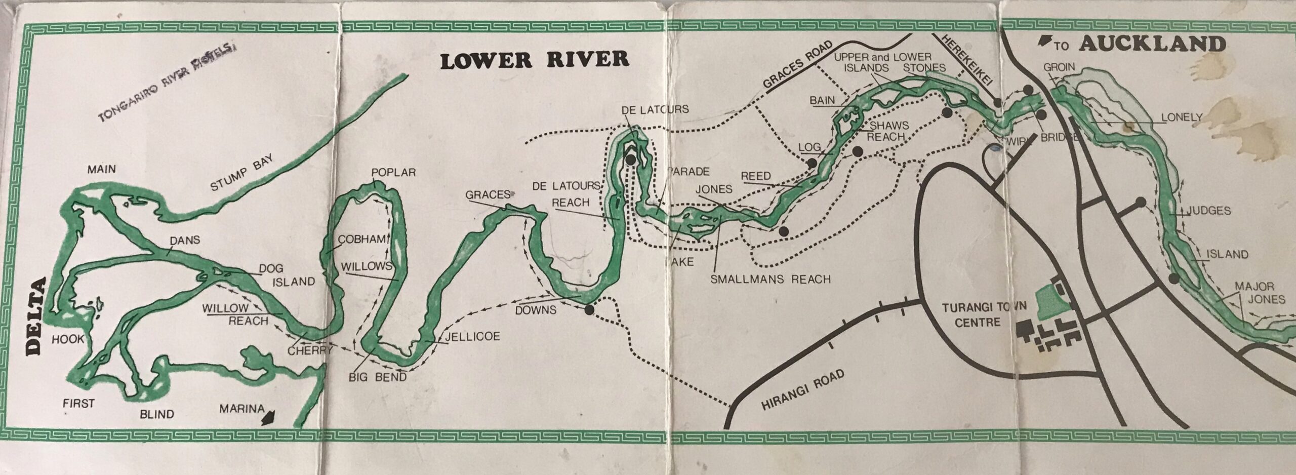
The map above was included in a book, “Fishing Guide to the Tongariro River and Lake Taupo’s Southern Shore in 1983. The authors claimed that their names of the pools were those officially recognised by the NZ Geographical Board. There were many changes with names used in the past quote: “Names used in the past [i.e. Toi, Boat] to describe pools which were in different positions to where pools now occur were not permitted to be re-used.”

However, their map has different names allocated to other versions. Since then, there have been many more changes, particularly after the river changed course after the 2004 flood and lost the Breakaway Pool and Dreadnought Pool, and several are now known by different names.
TRM agree with them all…
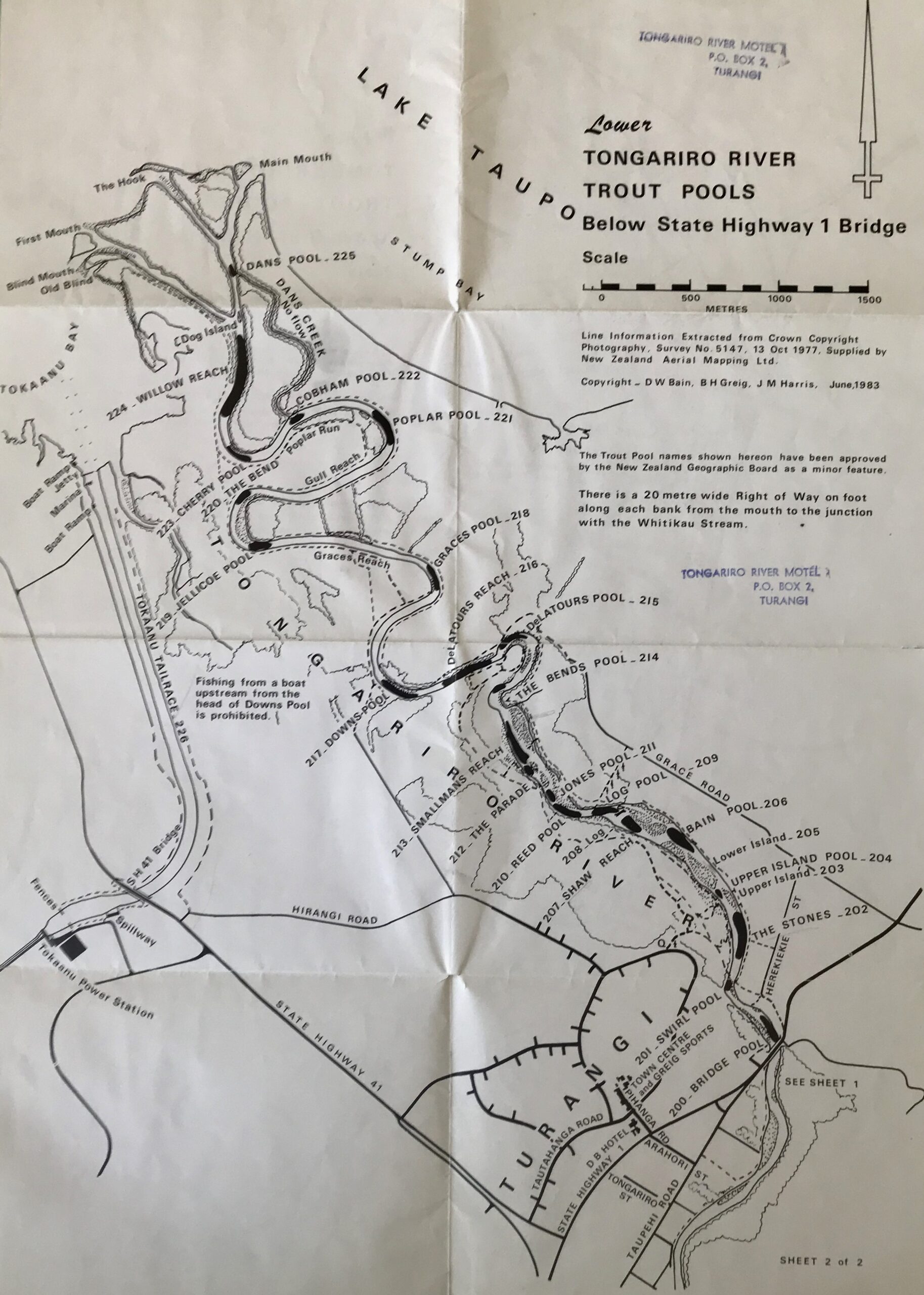
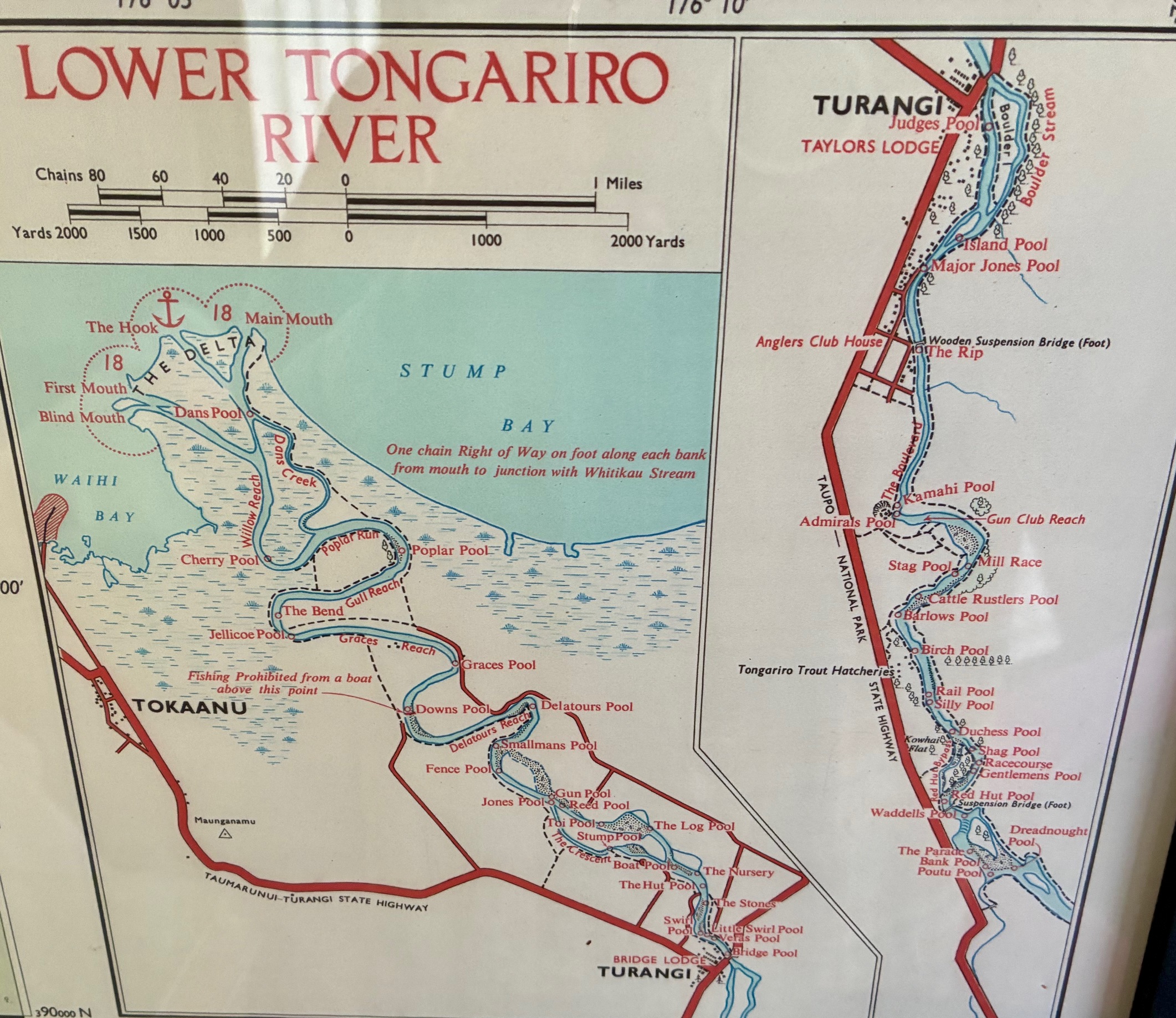
Other maps were published by the Department of Lands and Survey: Map of Lake Taupo, First, Third & Fourth Editions. The map below was the 1955 version with the names of pools as approved by the NZ Geographic Board. The names of pools was considered a serious business back then.
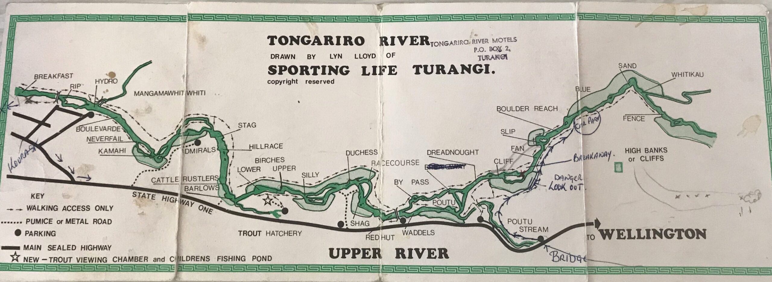
Another local version was the undated map below drawn by Lyn Lloyd of Sporting Life tackle shop in Turangi.
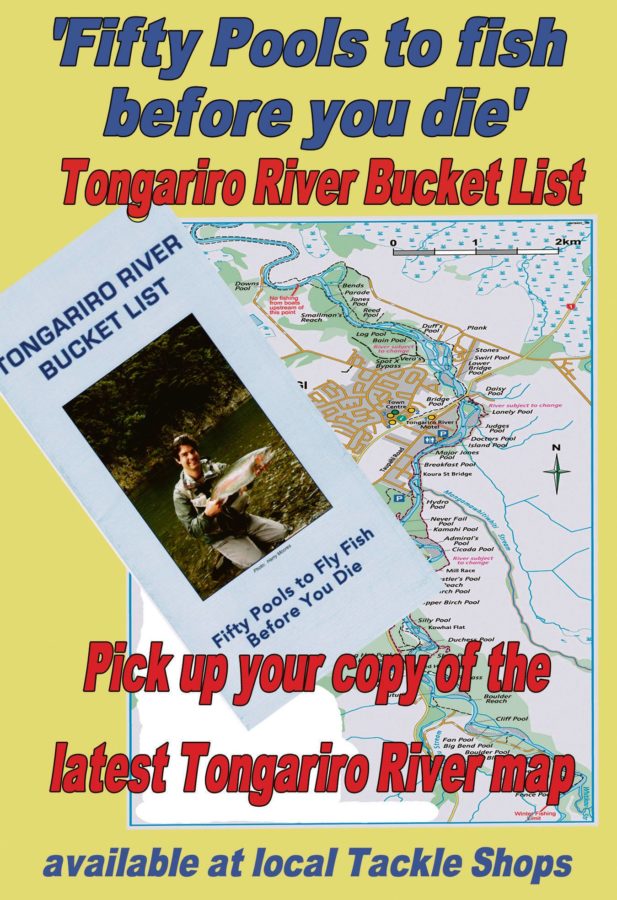
Last, perhaps most useful for anglers over the last fifteen years, is the 2024 updated edition published by Tongariro River Motel. This was originally designed to help novice anglers and was distributed (sold by?) in local tackle shops. This popular map was originally prepared with the Advocates of the Tongariro River to promote CCD (Check Clean Dry to avoid contamination by Didymo).

To assist novice anglers, it also included a controversial “Pools Rating Chart”, grading pools out of 20 for their attributes, such as ease of access (marked out of 3), difficulty (2) natural beauty setting (3), reliability (9), snags (1), wading (1), popularity or angling pressure(1). The popularity of this chart is confirmed by the last of the updated 2024 (4 th) updated edition of this map still only available at TRM reception. They will become collectors’ items soon.
It is of interest to note that this latest version reduces the Pool Ratings from the original fifty, leaving 35 pools rated. The explanation and reason was: “All pools downstream of the SH1 road bridge are subject to changes after floods and WRC (Waikato Regional Council) flood protection.”
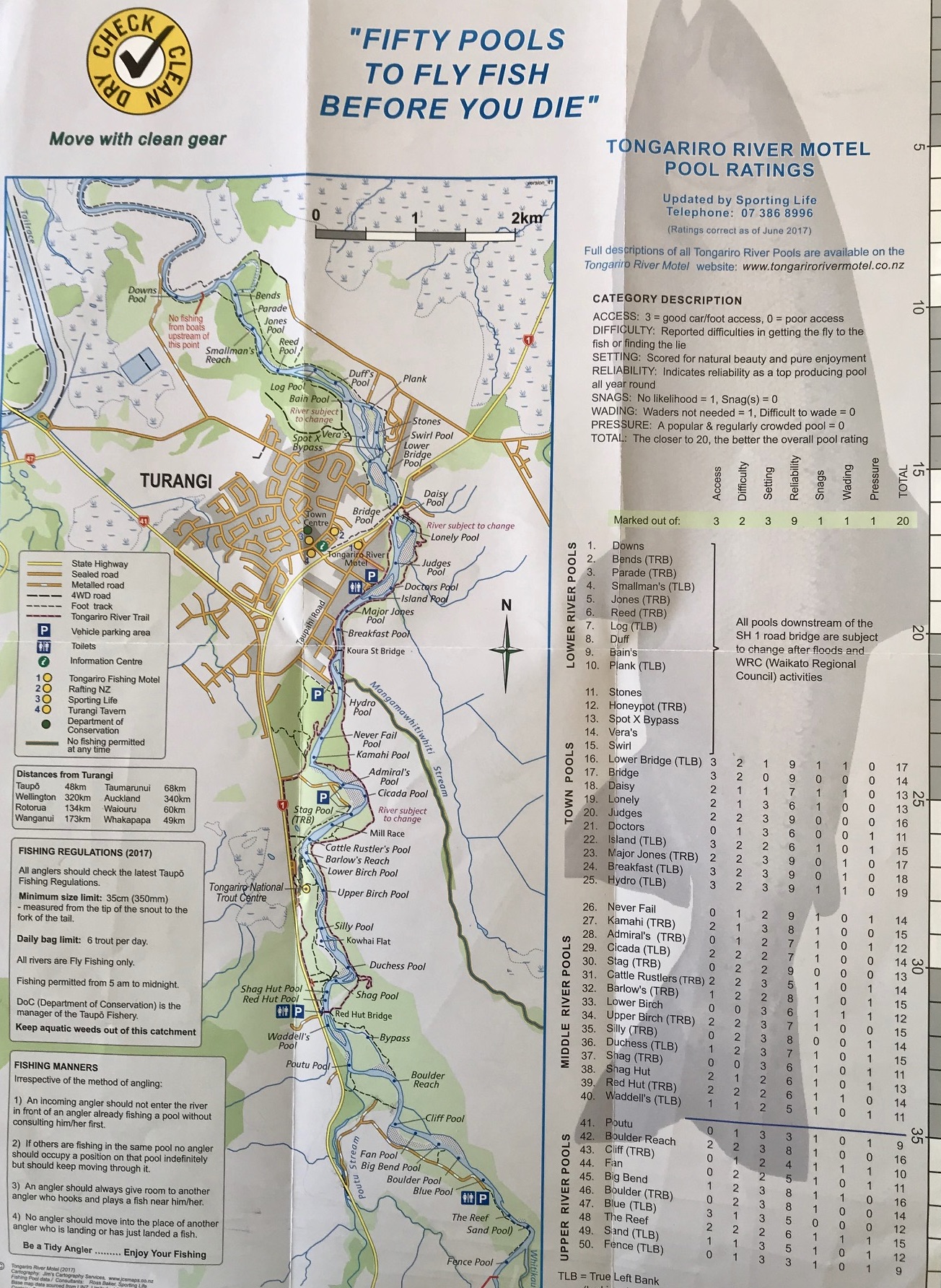
“Observant anglers will have spotted in the latest update that the names of these fifteen pools located below Downs Pool have been ignored on the latest 2024 map as they are no longer accessible (unless by boat) by car or by foot, with anglers’ tracks overgrown or blocked off.
This deliberate omission might attract an official Government enquiry as many of NZ’s “nobility”, in the form of previous titled Governors General, have lost much of their historic reputation by their removal from TRM’s latest map. For many years after the first 1927 Royal visit by the Duke & Duchess of York, a succession of NZ Governors General followed the noble example set by the Royals. Their New Zealand term included a compulsory annual “colonial safari style” visit to fish the Tongariro, camping in basic conditions, shared ablutions etc. at Taylors Camp on Taupahi Road. To enhance the Tongariro’s lore and trout fishing’s reputation, several pools were named after them, but only Admiral’s Pool – named after the Admiral of the Fleet – still remains. No other trout fishing river in NZ can match the rich history of the Tongariro anglers.
The other notable pools deleted in the lower river had been named after GG’s, included Jellicoe Pool, named after Lord Jellicoe, (1920-1924), Bledisloe Pool named after Lord & Lady Bledisloe, (1930 -1935), ditto Lord & Lady Galway (1935-1941), ditto Lord Cobham (1957-1962, Cobham Pool).

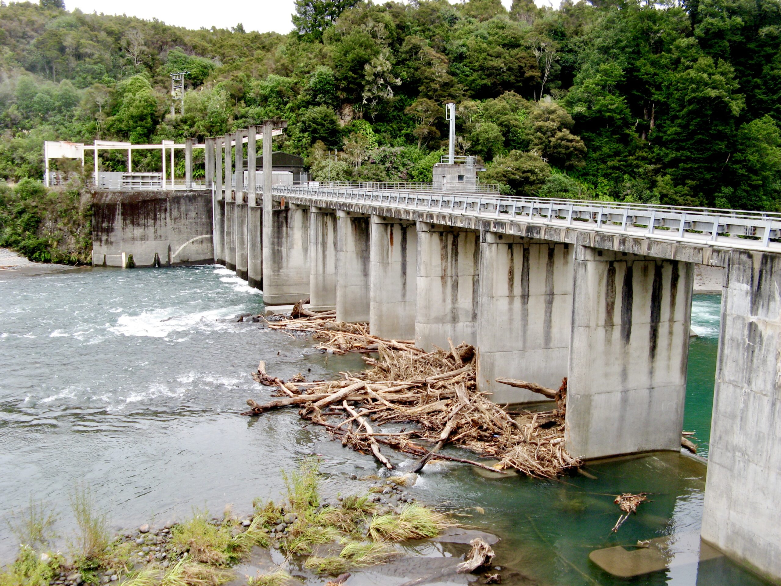
Since the Tongariro Hydro Scheme redirected water from the Tongariro River via the canal cross to Lake Rotoaira, which reduced the flow of the Tongariro River in 1975, the entire lower river has now suffered severe aggradation. The remaining reduced flow is inadequate, and the flow is not powerful enough to carry many tonnes of sediment down to the delta of Lake Taupo, so it has been steadily distributed through these slower river pools. This has raised the riverbed level, covering and destroying the most important Brown Trout nursery for Lake Taupo and significantly increasing the potential damage from flooding.

An official reaction by Taupo Council about five years ago was endorsed when many residential zoned properties throughout Turangi were rezoned to warn that they are now in danger by their location in a “Flood Hazard Zone”. (i.e. TRM has been in this location for 65 years but the TDC have now decided it is in a flood hazard zone for the last five…)