TRM needed to update the lower river access info for a special TRM visitor arriving later next week.
Since the previous lower river access update, dated June 13, there have been many more changes following other minor floods.

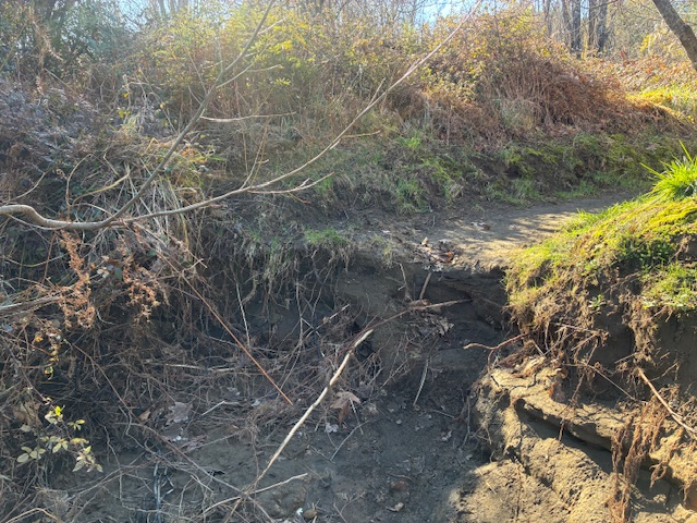
These photos were taken on a fine mild winter Friday around midday, when the river level was still recovering from the last flood a few days ago and still draining the catchment, flowing just over 40 cumecs. Previously anglers had been warned that access down to Reed Pool was too difficult for the more “mature” species. The photo below indicates the old track on the right washed away, with the new track hacked through the blackberry on the higher ground on the left.

Thank you DOC. Department of Conservation are the Taupo fishery managers and also responsible for track maintenance along the Tongariro River trails. The worst obstacles have now been sorted so there is only one large step before the track continues down to the beach where the bypass joins the main flow. From then on down past Jones Pool a wide track is located back from the shingle beach until it reaches a high bank where the current has swapped sides to erode the pumice bank.
This should be evident in the photos below which also includes some DOC contractors ripping through the blackberry jungle to resite the track further away from the river-bank erosion.

TRM’s last previous update on the lower river pools, repeated below, is now mainly obsolete. These reports are prepared in response to requests from regular tourist inmates, i.e. anglers from overseas, planning their two-week annual fishing trips, so they need to be well-informed. Unfortunately, I am not aware of any where else they can get similar, reliable updated info.

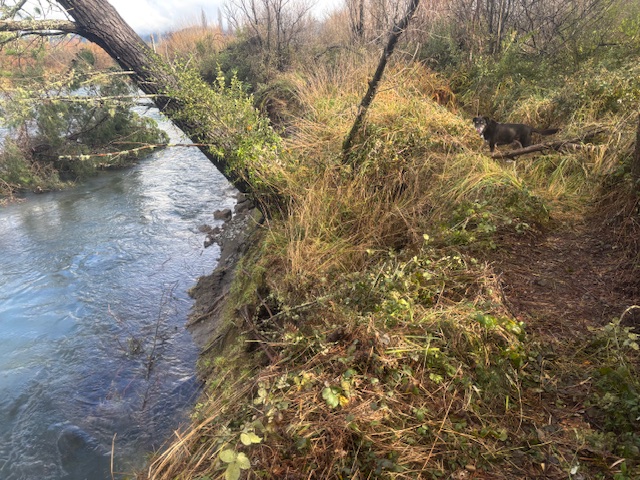
The photo above shows the previous access track on left dropping off into the river with the new track hacked through on the right. With the lower river contours rapidly changing due to increased aggradation causing erosion, they quickly become obsolete and can only be relied on as of that date. Hopefully the photos will be adequate to indicate the access difficulties. If you lean forward, you may be able to identify a 4WD vehicle on the beach in the distance. To drive to there, they have used the track from the end of Grace Road. This track surface has now been scoured out, hiding deep holes, and is only suitable for high-clearance 4WD trucks.
For the special guest next week, he also needs to be made aware of other obstacles that they might walk into, such as the trees lying across the track below.

The following info is for all those fishos who feel unfairly handicapped by any age-related deteriorating physical condition…
Regular readers of TRM blogs will remember Toni Marks who with his “guides”, has managed to access and wade the pools below Reeds for many years. They are staying at TRM for over a week so if you happen to see him innocently wading into your spot, make sure you greet him as he may not see you.

The last TRM update below is now mainly obsolete:
More access issues in lower river…
Weekend anglers need to be warned the walking access to the Reeds and Jones Pools had become more difficult. TRM’s photos should illustrate the problem. As the old Bridge Pool flow keeps changing the angling pressure has moved lower down the river. Photo below taken from the SH1 road bridge today with two anglers wading from the TRB. In past seasons all the action would have been on the TLB beach but the flow is now concentrated on that side where it is too strong for floating lines to sink.

In recent seasons, the Reed & Jones Pools have become more popular as the old Bridge Pool deteriorated and changed into a faster rapid.
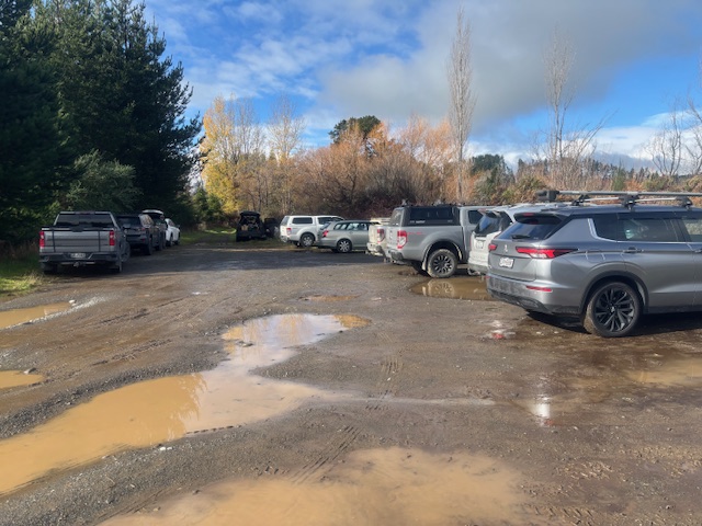
After the rain last night, today there were ten cars in the Braids car park. But the access track down the TRB from the Braids car park is now more challenging after the two recent overnight floods exceeding 700 cumecs.
So most of the anglers appear to have moved further downriver. Over the years, DOC has improved walking access below the Braids car park by building raised platforms above where the track usually ponds. See photo below:

Farmers suggest a better solution would have been to use gravity to drain the wet spots… but any improvement was appreciated.

A few years ago, above the Reed Pool, the erosion destroyed the original route and forced a new track up the bank over a fence through private pine plantation. Now that track back down to the river edge has eroded as well. The track access problem has increased where the temporary new track disappears into the river, so a more permanent route may need to be selected and negotiated with adjoining landowners.

Above is the latest “snag” above Reeds Pool. This will probably be swept down into Reeds Pool or beyond with the next flood. (Good anticipation – it has now gone!)
Anglers are warned the walking (waddling in waders) access is more precarious but the bank will continue to erode. Wading poles are recommended to be used like a third leg.

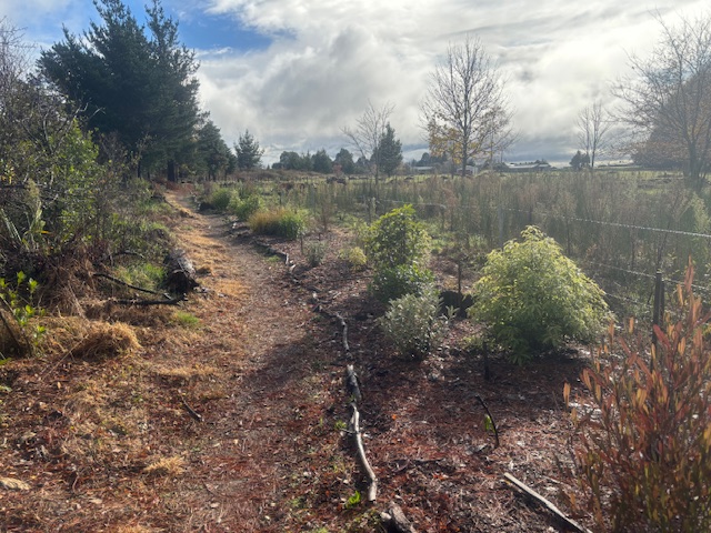
In the lower river above the Braids car park it is encouraging how adjoining land owners have landscaped and planted the boundaries and even provided tourist seating with view corridors looking up the bypass towards Mt. Pihanga.


The map below was drawn by Lyn Lloyd, original owner of Sporting Life tackle shop before Graham Whyman, and included to illustrate the vast changes to the Tongariro River lower reaches. Also notable are the number of access tracks, which are now neglected and overgrown and unavailable to anglers.
