Recent historical photos stirred up lots of comment from fishy inmates so here are some old survey maps to remind anglers of the “good ol’ days”…
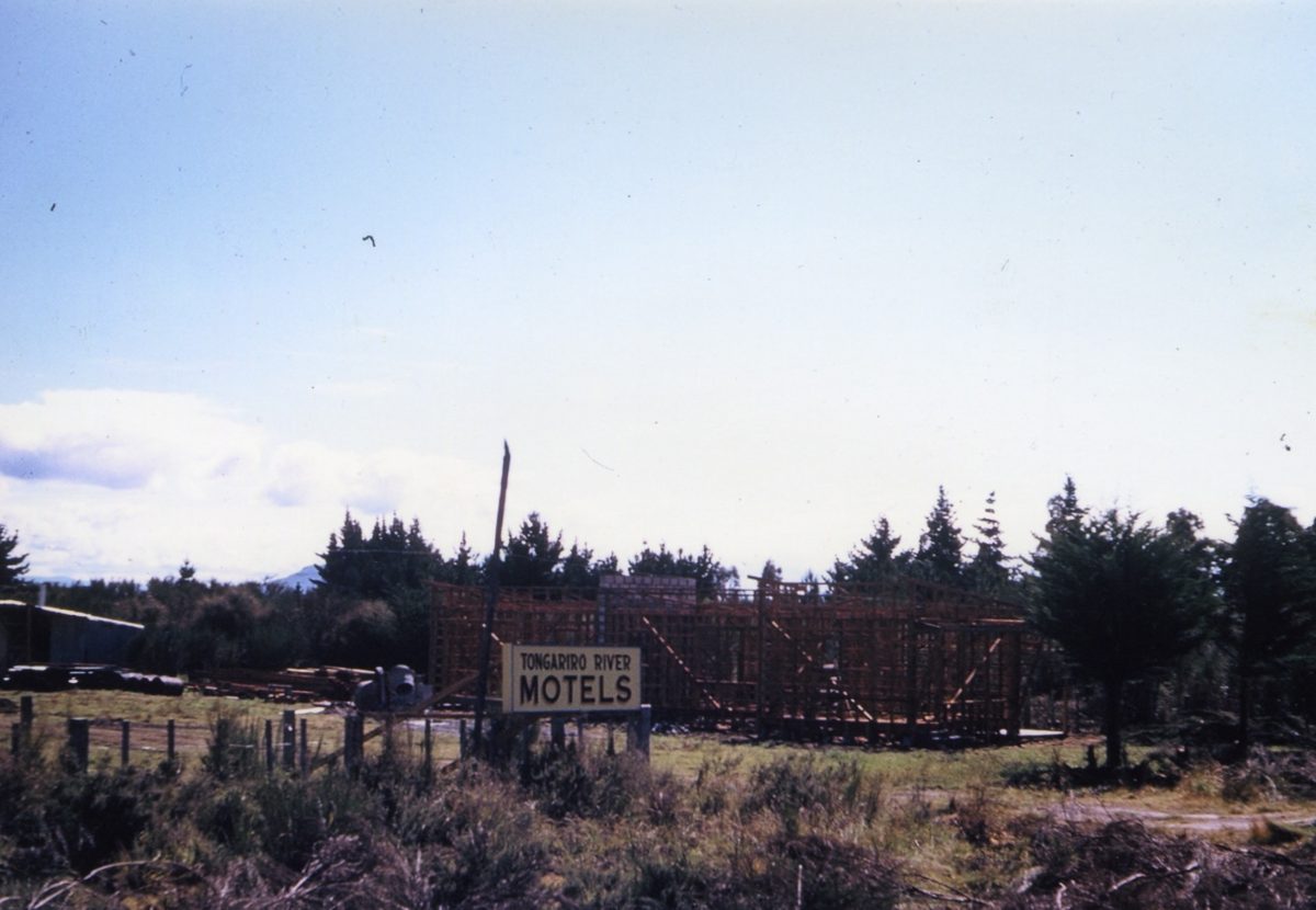
 Above is a 1960 aerial (Tiger Moth!) view of Tongariro River Motel… It was developed as more of a caravan park for anglers with a village shop at the front (now Units 1 & 2).
 Taupahi Road in the foreground was the main north road.
There was no Piri Road (previously known as Link Road) or SH1 at rear.
What is now Te Aho Road leading to Judges Pool was just a pumice residential drive.
Turangi township did not exist at all. The other lake edge settlements of Omori, (Kuratau had not been developed) Motuoapa, Te Rangiita (Tauranga Taupo River) and Waitetoko (Mission Bay) were all larger than Turangi.
 There was no ‘Trout Centre’ as such, but there was an anglers camp on the edge of the Tongariro River north of where the trout centre has now been developed.
Vehicle access extended beyond the end of Grace Road all the way to the Tongariro delta where there was an anglers camp.
There was no anglers access road up to the Blue Pool and the road bridge over the Poutu Stream – draining Lake Rotoaira was further north.
Then ‘Uncle” MOW (Ministry of Works) arrived with their bull dozers and graders. The photo of the grader above was forming SH1 immediately on the back boundary of TRM.

 The old survey maps may be of interest to anglers as above it shows Turangi as it was in 1955 (about when I first fished the Tongariro River…).
It was just a name for the intersection in 1955 – there was no Turangi town.
The main road was River Road – the north-south road outside Tongariro River Motel.
The only suburban streets were those connecting to the Tongariro River beside the Breakfast Pool.
 Next to the Tongariro River Bridge was the fishing lodge, three shops and the bus sheds serving the local school.
The main road connecting the much larger settlement of Tokaanu (and Waihi Village) was Hirangi Road (now located on the north western side of the town boundary).
There was no SH 41 across the Tokaanu power station tail race – indeed there was no power station and no Saddle Road – SH47 – connecting Lake Otamangakau which was then just low lying swamp land at the head of the Wanganui River (No “h” back then either).
 There were various “Fishing Lodges” with the main anglers retreat being Taylors Lodge (below) frequented by various Governors General since the 1920’s.
There were various other fishing lodges including one up the Waiotaka River in the Hautu Prison.

Tomorrow TRM Daily Report has the 1963 update (? nothing much changed) followed by the 1967 map (everything changed) followed by the 1978 map (much the same as today…). Don’t miss it.